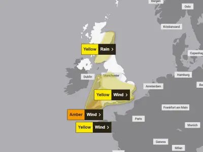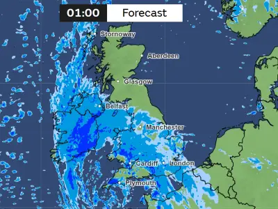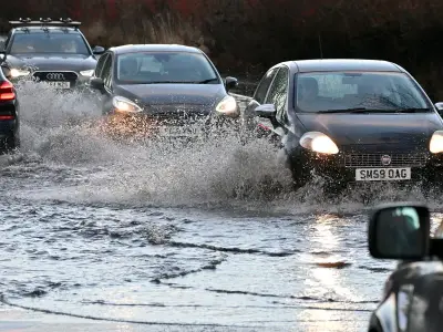
Natural Resources Wales (NRW) has issued 47 flood alerts and six flood warnings across Wales as Storm Boelo brings heavy rain and strong winds to the country. A yellow weather warning for rain from the Met Office remains in effect.
Met Office Warning and Affected Areas
The Met Office's 12-hour weather warning has been active since 11am on Saturday, warning of potential flooding on roads, disruption to public transport, and possible power outages. Strong winds have also been reported across Wales.
Flood alerts are currently in place for locations including Swansea, Cardiff, Powys, Pembrokeshire, and Dolgellau, among others. Rainfall initially struck western Wales around 6am, while simultaneously affecting southern areas such as Cardiff and Swansea.
List of Flood Alerts and Warnings
As of 8.50pm on Saturday, October 24, the 47 flood alerts cover rivers and coastal areas across the country. These include the River Taf, River Rhymney, North West Wales coastline, River Conwy at Gwydir Road, River Cynon, Lower Tawe, Rivers Rheidol, Ystwyth and Clarach, River Dyfi at Pont ar Ddyfi, Upper Severn catchment in Powys, Conwy catchment, Rivers Colwyn and Glaslyn at Beddgelert, River Wye in Powys, Rivers Afan and Kenfig, River Wnion at Dolgellau, Dysynni catchment, Dyfi catchment, Rhondda rivers, River Ewenny and Vale of Glamorgan west, Rivers Llynfi and Ogmore, Mawddach and Wnion catchment, Upper Tawe, River Cothi, Gower peninsula, River Neath, Rivers in Llanelli, Pembrokeshire coast, Carmarthenshire coast, Swansea Bay and the Gower coast, Ceredigion coast between Clarach and Cardigan, Rivers Nant-Y-Fendrod and Nant Bran, Lower Severn catchment in Powys, Vyrnwy catchment, Rivers Loughor and Amman, Upper Teifi, Glaslyn and Dwyryd catchment, Rivers Taf and Cynin, River Ely, Rivers Gwendraeths, Clwyd catchment, Elwy and Gele catchment, Lower Teifi, Rivers Bran and Gwydderig, Lower Towy, Upper Towy, North East Wales coastline, West Anglesey coastline, Llyn Peninsula and Cardigan Bay coastline, River Ely at Talbot Green, River Ely at Peterston Super Ely, River Towy at Llanwrda, River Rhondda at Porth, and River Lower Clydach at Clydach Bridge.
Met Office Forecaster's Statement
Earlier on Saturday, Met Office deputy chief forecaster Mark Sidaway said: "Saturday morning will start dry and bright in the east of the UK, however further west rain and increasingly windy conditions will already be set in as people wake up for the day. This stormy weather will continue to move eastwards bringing rain and windy conditions to all of the UK."
He added: "There are a number of severe weather warnings issued for Storm Boelo, including an Amber warning for all of mainland Scotland, parts of Northern Ireland and the very far north of England. Gusts could reach up to 80mph in places. More widely gusts will still reach 50-60mph and spells of heavy rain could also lead to some impacts."
Sidaway advised: "People should prepare by securing loose items outside their property, being ready in case of power outages and being aware of likely travel disruption."
Residents can check their flood risk by postcode on the Natural Resources Wales website.