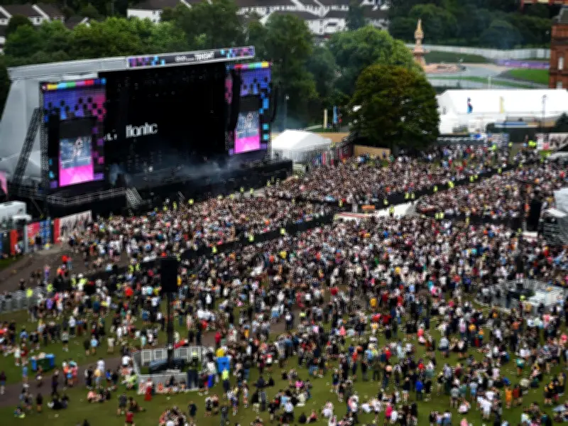
As thousands of music fans prepare to descend on Glasgow Green over the weekend for this year's TRNSMT, there are a number of travel options available to help ticket-holders get to and from the festival as smoothly as possible.
Entrance Details
With large crowds expected across the weekend, most attendees will enter the site via the west entrance which is accessed from the Saltmarket and Merchant City area. The east entrance will be reserved for VIP ticket-holders and those needing accessible entry, helping to manage flow and improve accessibility across the site.
Travel Options
There are many ways to arrive at the festival such as by car, bus, train, subway and foot. Below we have put together a list of everything you need to know for each mode of transport to make your journey to and from the festival as hassle-free as possible.

Train Travel and Extra Services
ScotRail will be putting on extended services after the festival finishes. ScotRail is adding extra carriages to services running in and out of Glasgow throughout the festival weekend, aiming to accommodate the large number of passengers. In addition, a number of late night services will operate after the festival is finished, providing fans with additional travel options back to surrounding towns and cities.
These include the following services:
- Glasgow Queen Street High Level to Edinburgh Waverley via Falkirk High
- Glasgow Central to East Kilbride
- Glasgow Central to Ayr (Saturday and Sunday)
- Argyle Street to Motherwell
- Bridgeton to Garscadden
However, organisers have noted that these additional late night trains will only run after the music has ended each evening and won't extend to the football on Friday, June 19. This means there will be no additional train services available after the Scotland vs Morocco match has finished on the Friday evening, so fans will need to work out how to get back before they decide to stay for the football.
Subway and Bus Connections
Glasgow's subway system has been heavily used throughout the years when the festival has been on, as the network provides useful access for those living in Glasgow or staying in the area. Glasgow Green is located within a 15-minute walk from two subway stations - Buchanan Street and St Enoch. Glasgow Subway offers a simple way for attendees to reach the city centre quickly, particularly during peak arrival times. Although it is important to note that subway services will not be running on Sunday evening when TRNSMT has finished.
For those travelling by bus, Glasgow's main hub at Buchanan Bus Station is approximately a 20-minute walk from Glasgow Green, making it another practical option for festival-goers.
Road Closures and Drop-Off Points
Due to extensive road closures around the city centre during the festival, private vehicles will not be able to access areas close to Glasgow Green. Instead, organisers have designated four recommended drop-off and pick-up locations to help manage traffic. These locations are:
- Duke Street at High Street (north)
- Caledonia Road (south)
- London Road east of Bridgeton Rail Station (east)
- Broomielaw west of Oswald Street (west)
An accessible pick-up and drop-off point will also be in operation for those who require it.
Parking and City Centre Access
For those driving into Glasgow, seven car parks are located within a 15-minute walk of the venue, including: Q Park Albion Street, City Parking Duke Street, NCP Montrose Street, Merchant City High Street, NCP King Street, NCP Glassford Street, and NCP Dunlop Street. These carparks offer several thousand spaces, although demand is expected to be high across the weekend.
Drivers are also being reminded that Glasgow city centre operates within a Low Emission Zone (LEZ), meaning all vehicles entering must meet emission standards or risk a penalty charge. Drivers are advised to plan routes carefully to avoid unnecessary travel through restricted areas.