
UK Flood Alert Map: Hundreds of Warnings Issued Amid Heavy Rain
Hundreds of flood alerts and warnings are in place across the United Kingdom on Monday, following the issuance of weather warnings by the Met Office for more heavy rain this week. Bands of heavy rain are set to batter parts of southern England and Wales, with a yellow weather warning active during Monday afternoon and evening.
Rainfall and Impact Details
The forecaster indicated that at least 10 to 15mm of rain is likely fairly widely, with 20 to 30mm expected in areas exposed to strong south to south-easterly winds as the showers move in an easterly direction. The Met Office warned that flooding on roads could cause significant travel disruption, impacting bus and train services, and also affect homes and businesses. There is also a chance of some interruption to power supplies, adding to the potential hazards.
Extended Warnings for Scotland
Further yellow weather warnings have been issued for persistent and at times heavy rain over Scotland all day on Tuesday and Wednesday, with a sprinkling of snow anticipated. Around 15 to 30mm of rain could fall widely on Tuesday, with 40 to 60mm possible in places over higher ground, impacting Central, Tayside, Fife, and Grampian regions. Some snow may affect the highest roads in Aberdeenshire by the end of Tuesday.

On Wednesday, a further 20 to 30mm of rain could fall, with potential for another 40 to 60mm building up over high ground. As freezing levels lower from the North, snow is likely to fall above 300 to 400m, especially across Aberdeenshire, Angus, and Perthshire, where 5 to 10cm of snow may accumulate by the end of Wednesday.
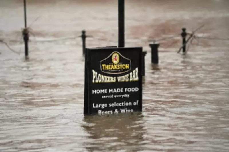
Flood Alert Statistics and Hotspots
Meanwhile, the Environment Agency has issued 108 flood warnings, where flooding is expected across England, and 218 flood alerts, where deluge is possible. A map highlights south Wiltshire and Dorset, as well as parts of Gloucestershire and the West Midlands, as hotspots for flooding. Only two flood alerts and four warnings are in place across Scotland on Monday, while Wales has seven alerts active.
Context of Persistent Rainy Spell
The UK continues to face a persistent rainy spell, after the Met Office confirmed last week that rain had been recorded on every day of the year so far. After recording 36 days of rain in a row, Met Office spokesperson Stephen Dixon stated, "Rain has been reported somewhere in the network every day of the year so far. While amounts are trivial on some days, and some areas will have seen dry days, the UK has seen a wet start to the year, particularly in Northern Ireland and southern England."
He added, "This has largely been down to a succession of fronts or low-pressure systems arriving from the west, bringing heavy rain at times, as well as damaging winds for some. There’s little sign of a let-up in the current forecast, with further unsettled weather in the coming days and over the weekend."
Record Rainfall and Historical Data
Northern Ireland recorded its wettest January in 149 years – the second wettest on record after Storm Chandra brought record-breaking rainfall across a number of UK sites. Katesbridge in County Down recorded a staggering 100.8mm of rain, far surpassing the previous site record of 38.2mm from 2005, on 26 January. Other notable records include Dunkeswell Aerodrome in Devon reaching 52.8mm, while Hurn in Dorset, Cardinham in Cornwall, and Plymouth Mountbatten in Devon all exceeded their previous daily records.
Weekly Weather Forecast
The Met Office weather forecast for the week outlines the following conditions:

- Monday: A grey start for many with outbreaks of rain and drizzle. Staying largely cloudy, although some brighter spells possible. Heavy rain and strong winds pushing into the South West with a risk of flooding. Rather mild in the South. Cloudy skies for most tonight with further outbreaks of rain. Heavy rain and strong winds gradually easing in the South West.
- Tuesday: Another dull start with outbreaks of rain and drizzle. A spell of heavy rain will move into the South, followed by sunshine and showers. Staying cloudy and damp elsewhere.
- Outlook for Wednesday to Friday: Staying unsettled at first with further outbreaks of rain for many. Turning colder and brighter on Friday with a chance of snow showers, particularly in the North and East.


