
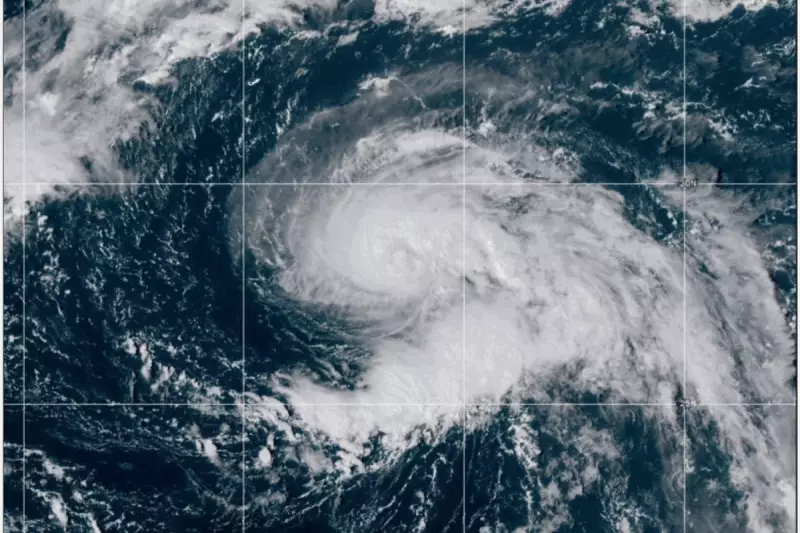
The Atlantic Ocean has birthed a new weather system, with the National Hurricane Center (NHC) in Miami declaring the formation of Tropical Storm Gabrielle. The storm is being closely monitored for its potential development and path across the ocean.
As of the latest advisory, Gabrielle was located approximately 1,000 miles east-southeast of Bermuda. Meteorologists report maximum sustained winds of 40 mph (65 km/h), with the storm moving north-northwest at 10 mph (16 km/h).
Projected Path and Potential UK Impact
While it is too early to predict with absolute certainty, current modelling from the NHC suggests Gabrielle is expected to make a gradual turn toward the north and then northeast over the coming days. This projected track is critical for UK forecasters at the Met Office, who are assessing the potential for the storm to influence British weather later next week.

This does not mean a direct hit is likely, but rather that the remnants of the storm could merge with the jet stream, potentially bringing periods of heavy rain and stronger winds to parts of the UK and Ireland.
What This Means for the UK
The main concern for the UK revolves around indirect impacts. The energy from ex-tropical storms can intensify existing weather systems, leading to:
- Heavier than average rainfall, potentially causing localised flooding.
- Unseasonably strong winds, which could disrupt travel and ferry services.
- Uncertainty in the forecast for coastal areas, particularly in the west.
The Met Office has stated they are keeping a close watch on the system and will issue updates and any necessary warnings as the forecast becomes clearer. Residents, especially those with travel plans or living in flood-prone areas, are advised to stay informed on the latest developments.


