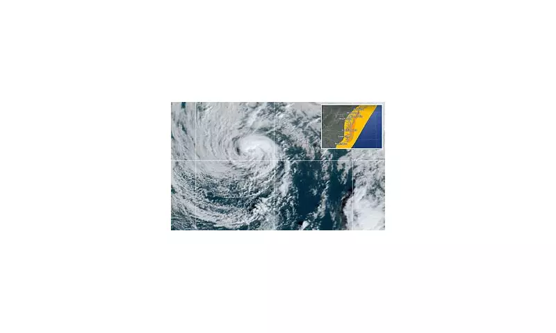
A formidable nor'easter, now named Storm Karen, is currently hammering the East Coast with relentless rainfall and dangerous flooding conditions. The powerful weather system has prompted urgent warnings from meteorologists as it continues to intensify.
Widespread Disruption and Emergency Response
Millions of residents across affected regions are waking up to significant disruption as Karen's torrential downpours overwhelm drainage systems and cause rivers to swell beyond their banks. Emergency services have been deployed to multiple locations to assist stranded motorists and conduct flood rescues.
Key impacts being reported include:
- Road closures and dangerous travel conditions
- Localised flooding in low-lying areas
- Power outages affecting thousands of households
- School closures and business disruptions
- Coastal erosion from pounding surf
Meteorological Analysis: Why This Storm Packs a Punch
Weather experts confirm this system qualifies as a classic nor'easter, characterised by its counter-clockwise rotation drawing moisture from the Atlantic Ocean. The storm's unique positioning is creating a perfect setup for prolonged, heavy precipitation along its path.
"What makes this system particularly concerning," explained a senior meteorologist, "is the combination of tropical moisture and cooler northern air creating ideal conditions for extreme rainfall rates. Some areas could see rainfall totals exceeding historical averages for this time of year."
Safety Precautions and Official Guidance
Residents in affected areas are being advised to take immediate precautions:
- Avoid unnecessary travel, especially through flooded roads
- Move valuable items to higher ground in flood-prone properties
- Prepare emergency kits with essential supplies
- Monitor official weather channels for updates
- Check on vulnerable neighbours and family members
Local authorities have established emergency shelters in the hardest-hit communities, while utility companies have additional crews on standby to address power restoration as conditions permit.
Looking Ahead: Storm Trajectory and Duration
Current projections indicate Storm Karen will continue affecting the region for the next 24-48 hours before gradually moving offshore. However, meteorologists warn that flood impacts may persist even after the rain subsides as water continues to flow through watersheds.
The situation remains fluid, with weather officials urging the public to maintain vigilance and follow all safety advisories until the system fully passes and floodwaters recede.


