
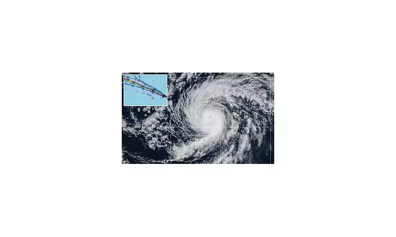
Meteorological eyes are fixed firmly on the Pacific Ocean as Hurricane Kiko continues its powerful journey, with the latest forecasting models painting a concerning picture for the Hawaiian Islands.
The storm, currently a formidable force, is being tracked by experts who are analysing a complex web of data known as 'spaghetti models'. These ensembles, which plot numerous potential paths, show a significant cluster of trajectories arcing towards the archipelago, raising the alert level for residents and officials.
Decoding the Spaghetti Models: A Path of Uncertainty
The term 'spaghetti models' refers to the computer-generated forecast models that resemble strands of pasta on a map. Each line represents a different simulation of the hurricane's potential path based on varying atmospheric data. While they can appear chaotic, they are crucial for understanding the range of possibilities and the most probable course.

For Kiko, the current model spread indicates a general northwesterly turn is expected. The critical question remains how sharp that turn will be and its timing, which will ultimately determine whether Hawaii experiences a direct impact, a glancing blow, or remains safely out of harm's way.
Current Strength and Projected Intensity
As of the latest advisory, Hurricane Kiko maintains significant strength. Fluctuations in intensity are common as storms interact with varying water temperatures and wind shear. Forecasters are not only monitoring its path but also its power, as even a weakened system can bring devastating rainfall and surf to coastal areas.
The Central Pacific Hurricane Centre is providing continuous updates, emphasising that it is still too early to determine the exact level of threat to any specific island. However, they urge all residents across Hawaii to review their hurricane preparedness plans.
Historical Context and Preparedness
Hawaii, while in the path of Pacific storms, has a history of narrow escapes and direct hits. The memory of previous hurricanes reinforces the need for vigilance. Officials are advising the public to monitor official sources closely and to avoid relying on a single, deterministic forecast model.
The coming days will be critical as the storm's movement becomes more defined. Key factors being watched include the strength of a high-pressure ridge to the north and the potential development of other weather systems that could influence Kiko's steering currents.
For now, the message from forecasters is one of watchful waiting and prudent preparation, a reminder of the immense power of nature and the importance of modern forecasting in safeguarding communities.


