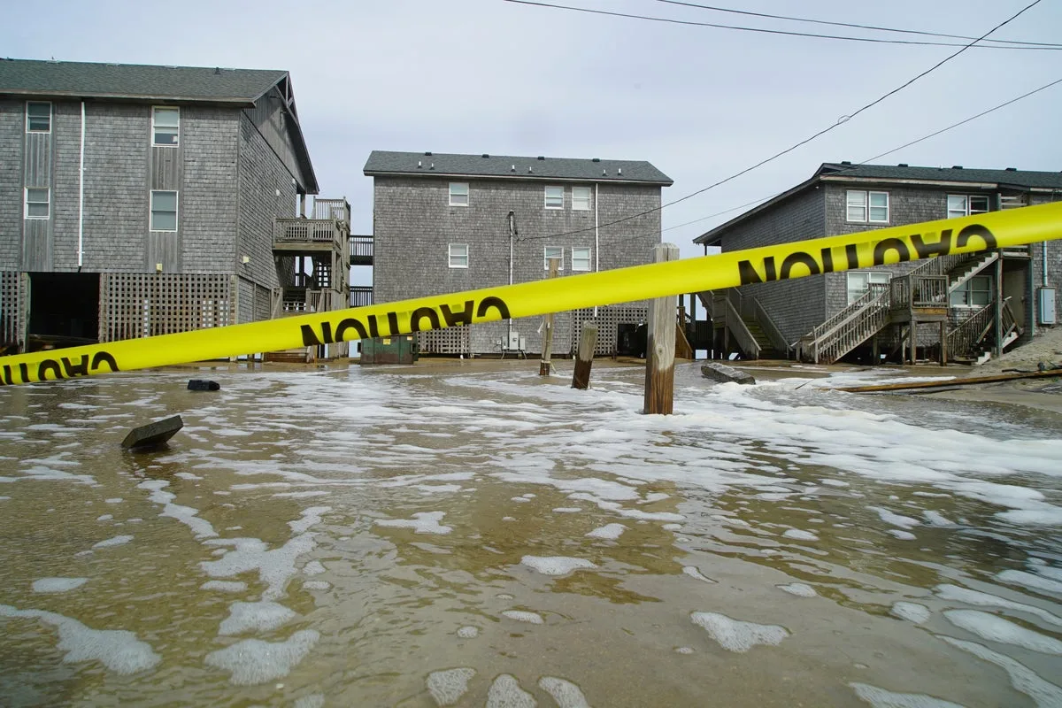
Hurricane Erin has battered the Outer Banks of North Carolina with strong winds and waves, flooding part of the main highway and surging beneath beachfront homes as it creeps towards the mid-Atlantic coast. Forecasters expect the storm to peak on Thursday and have not ruled out it regaining Category 3 strength, though it is not expected to make landfall before turning out to sea.
Tropical storm conditions are anticipated over parts of the Outer Banks and the Virginia coast. On Wednesday evening, officials closed Highway 12 on Hatteras Island as the storm surge increased, cutting off access to Ocracoke Island's ferry terminal. Residents were advised to stay indoors, and beach closures were enforced in New York City, parts of New Jersey, Maryland and Delaware, with further warnings of coastal flooding on Long Island and in New York City.
The threat of life-threatening rip currents extends from Florida to New England, with the largest swells expected during high tide. Nantucket Island could see waves of more than 10 feet (3 metres) later this week. In North Carolina, officials warned of coastal flooding caused by waves estimated at about 20 feet (6.1 metres). "Dangerous conditions can be felt far from the eye, especially with a system as large as Erin," said Will Ray, the state's emergency management director.
Despite evacuation orders on Hatteras and Ocracoke Islands, most residents stayed. Jacob Throne, who lives on Hatteras and works for surf shops, said he was not too concerned, recalling canoes from his front yard. Rob Temple, who operates sailboat cruises on Ocracoke, worried that the main route could wash out, cutting off tourists and delivery trucks from the low-lying islands. David Hallac, superintendent of the Cape Hatteras National Seashore, warned that dozens of beach homes already weakened by erosion were at risk.
The National Hurricane Center said Erin remained a Category 2 hurricane late Wednesday with maximum sustained winds of 110 mph (180 km/h), located about 215 miles (350 km) southeast of Cape Hatteras. The storm is unusually large, with tropical storm-force winds extending across 500 miles (800 km). Bob Oravec of the National Weather Service cautioned that rip currents remain dangerous even for those who think they know how to handle them. Meanwhile, forecasters are monitoring two tropical disturbances far out in the Atlantic that could develop into named storms.
Climate scientists note that Atlantic hurricanes are now much more likely to rapidly intensify into powerful and catastrophic storms because of warmer oceans. In Bermuda, residents and tourists were told to stay out of the water through Friday because of rough seas.