
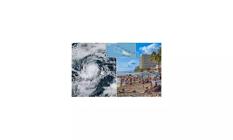
Hurricane Kiko has undergone a period of rapid intensification, transforming into a formidable Category 4 storm over the open waters of the Pacific Ocean. With sustained winds now reaching a staggering 130 mph, the storm presents a significant meteorological event that is being watched with keen interest.
The latest advisory from the National Hurricane Center places Kiko approximately 1,400 miles east-southeast of Hilo, Hawaii. While the storm's core remains far from land, its future path holds considerable uncertainty, leaving the possibility of a Hawaiian impact on the table.
Tracking the Storm's Erratic Path
Forecast models are currently presenting a complex and challenging picture. Some projections indicate that Kiko may continue on a west-northwesterly track, potentially bringing it closer to the Hawaiian archipelago by the middle of next week. However, other models suggest a different scenario, where the storm could curve northward, steering it away from the islands and out into the open ocean.

This divergence in predictions is common with Pacific storms, making it crucial for residents not to focus on a single model but to follow official updates from the Central Pacific Hurricane Center.
Hawaii Urged to Prepare
Despite the uncertainty, officials are urging residents across the Hawaiian Islands to use this time to review their hurricane preparedness plans. Now is the ideal moment to ensure emergency kits are stocked with essential supplies, including water, non-perishable food, medications, and batteries.
Historically, Hawaii has faced direct threats from tropical systems, and the memory of past storms underscores the importance of being ready. Even if Kiko does not make a direct landfall, the system could still generate dangerous surf, rip currents, and heavy rainfall along coastal areas.
A Season of Activity
Kiko is the second major hurricane to form in the Eastern Pacific this season, highlighting a period of heightened tropical activity. Meteorologists are closely monitoring atmospheric conditions, including sea surface temperatures and wind shear, which will play a critical role in determining Kiko's strength and ultimate direction in the coming days.
All eyes remain on the Pacific as experts work to unravel the complex atmospheric patterns guiding this powerful storm.


