
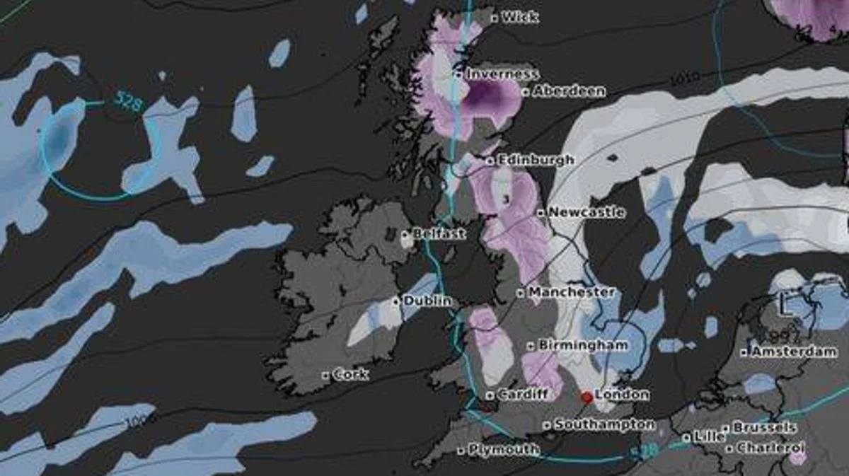
The UK is bracing for an Arctic blast next week, with weather maps predicting significant snowfall across 13 counties. According to the WXCharts model, a cold snap will sweep southwards from Thursday, March 13, bringing wintry conditions to Scotland, Northern Ireland, northern England, and the Midlands.
Major cities including Inverness, Aberdeen, Edinburgh, Newcastle, Manchester, and Birmingham are expected to be affected. The Arctic air mass could bring snow depths of up to 10cm in some areas, accompanied by strong winds and sub-zero temperatures. The blast spans 647 miles from Wick in Scotland to Cardiff in Wales.
The hardest-hit areas are forecast to be the Scottish Highlands, Aberdeenshire, Perth and Kinross, and the Borders, followed by Northumberland, Cumbria, County Durham, Yorkshire, Staffordshire, Derbyshire, and Shropshire in England, and Antrim and Down in Northern Ireland. The Met Office has not yet issued official warnings, but icy roads and transport disruption are possible.
Further south, London, Cardiff, and Southampton may avoid heavy snow, but freezing temperatures and icy conditions could still cause problems for commuters. The snow is expected to continue until the end of next week, with wintry showers possibly extending into the weekend.
Deputy Chief Meteorologist Chris Bulmer said: 'A frontal zone will move south across the UK during Sunday night and Monday with much colder air following from the north. With these cold northeasterly winds, we are likely to see some wintry showers across the north and the east of the UK next week, but any accumulations of snow are likely to be largely restricted to hills.'




