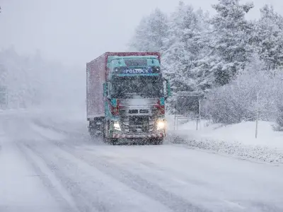
The Met Office has identified the parts of the UK set to see snow over the next week, with temperatures falling as low as -4C in some areas. Winter conditions have arrived, with temperatures already below zero in several regions and some areas experiencing snowfall.
Snow expected in Scottish counties
According to Met Office maps, hilly areas of Scotland, such as the Cairngorms, are the most likely to see snow next week, with snowfall projected for Tuesday, November 24. Snow is expected to be largely confined to the counties of Invernesshire, Aberdeenshire, Nairnshire, Elginshire and Banffshire.
Temperatures are set to drop to -4C today in parts of Scotland, including Aberdeenshire. The coldest parts of the UK this weekend will be Scotland and the North of England, with -4C forecast in Dumfries and Roxburghshire. On Saturday, temperatures of 0C and below will be widespread across Scotland.
Chilly but milder elsewhere
Other parts of the country will be chilly but not as bitter. In the south-west of England, temperatures will reach highs of around 12C in areas such as Cornwall and Devon. On Monday, temperatures could drop below zero again, with -3C predicted in parts of Scotland.
The Met Office's current forecast predicts a chilly day for most, with cloud and rain clearing the south through the morning, leading to some sunny spells later. It will be chillier but brighter further north, with scattered showers along the North Sea coasts, turning "wintry in the far north".
Frost and fog overnight
Tonight will be largely dry, though some showers will appear in the far north. Clear skies will allow for widespread frost development. "With light winds, fog patches develop across central and southern England and Northern Ireland," the forecast adds.
Saturday's forecast reads: "A crisp start to the weekend, with long sunny spells through the day. Skies turn cloudier in the southwest with rain later and strong winds developing towards the coast overnight."
Outlook for next week
The Met Office's outlook for Sunday to Tuesday predicts persistent rain across the southwest with strong winds on Sunday, but drier conditions elsewhere with sunny spells. It will be frosty overnight on Sunday to Monday, with winds easing before strengthening again as rain arrives from the west on Tuesday.
As December approaches, there will be "erratic and uncertain eastward progress across the UK" as bands of rain move in from the Atlantic. "Either side of bands of rain a mixture of clear/sunny spells and showers," the Met Office says. "Often rather cold in northern areas which could allow precipitation to fall as snow at times, mainly over hills."
Generally milder in the south, though still potential for some cold nights in clearer spells. Through late November, there is an increasing chance that high pressure will start to have more influence, bringing more settled conditions, particularly across the north. Temperatures are likely to stay close to average, although an ingress of colder conditions cannot be ruled out.