Britain is currently enjoying its third heatwave of the year, with temperatures soaring beyond 30C. However, this scorching spell is expected to come to a sudden halt as a 200-mile deluge prepares to strike next weekend.
Rain Forecast for July 19
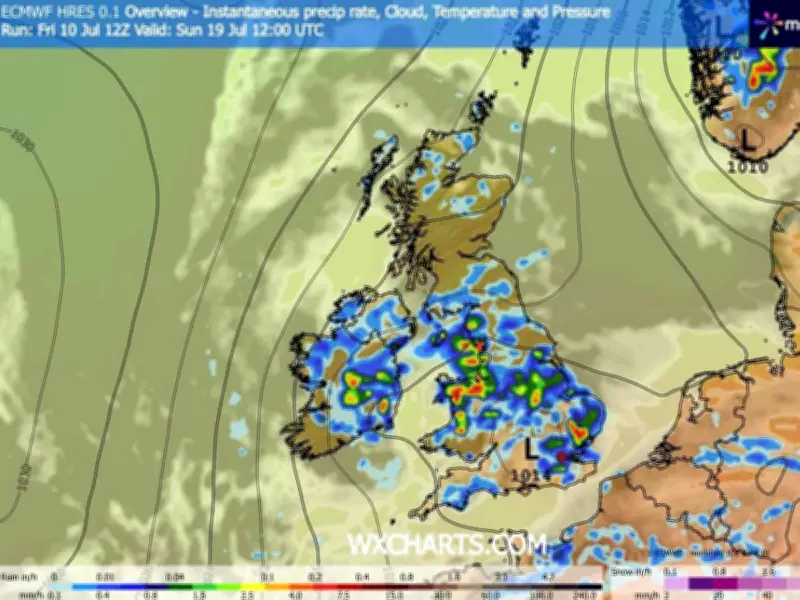
Fresh weather maps from WXCharts, using MetDesk data, indicate that changeable conditions may return next weekend, bringing rainfall across 25 counties. On July 19 (next Sunday), a massive band of rain is predicted to stretch from Cumbria in North West England all the way to Northamptonshire in the East Midlands—an enormous 220 miles.
Meanwhile, the East of England is also set for heavy showers, with Suffolk expected to receive up to 7.5mm/hr next Sunday. The Met Office has issued warnings about potential thunderstorms from mid-July, with increasingly volatile weather possibly ahead.
Met Office Outlook
The Met Office outlook for July 15 to 24 states: "High pressure to the northeast of the UK with low pressure over the Bay of Biscay starts the period with broadly settled weather for the north of the UK with a risk of thunderstorms into the south of the UK from France at times."
"Through the weekend potentially turning more unsettled from the south before more settled conditions arrive from the west. Uncertain into the next week as cloud and longer spells of rain threaten the NW and possibly running through the UK at times."
"Temperatures will be warm or very warm initially, perhaps hot at times in the southwest, likely easing to warm or near average over the weekend, though further hot spells possible especially in the south."
Counties Anticipating Rainfall
The 25 counties forecast to be affected include: Devon, Dorset, London, Surrey, Suffolk, Norfolk, Essex, Lincolnshire, Cambridgeshire, Northamptonshire, Warwickshire, Worcestershire, Herefordshire, Shropshire, Cheshire, Merseyside, Lancashire, Cumbria, Nottinghamshire, Derbyshire, Rutland, Leicestershire, Durham, Hertfordshire, and Buckinghamshire.