
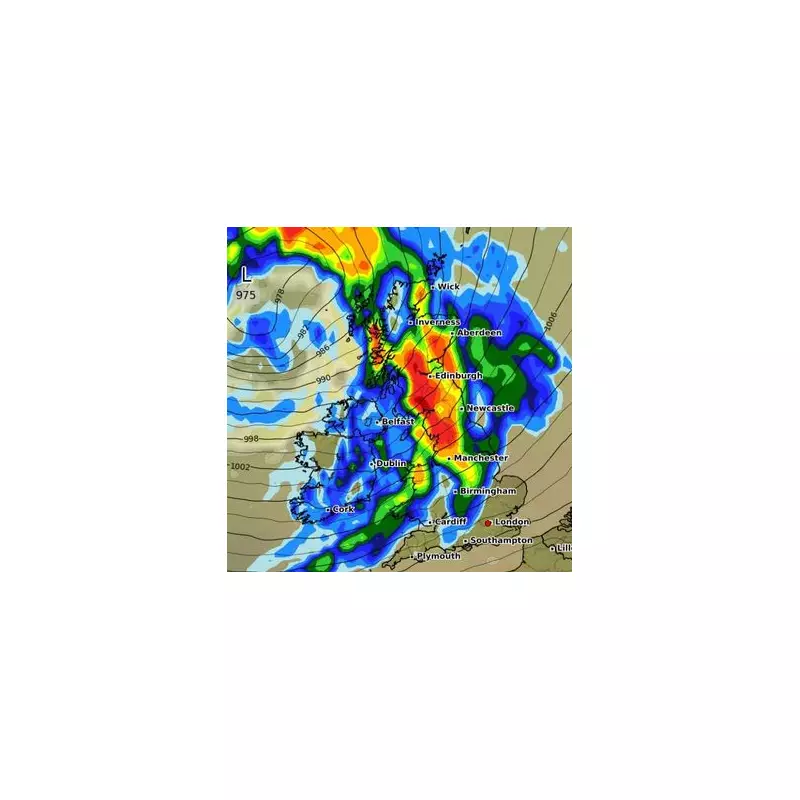
Britain is bracing for a spectacular winter onslaught as startling new meteorological maps forecast a devastating 500-mile 'monster' snow bomb ready to detonate across the nation within days.
The chilling weather models, visualising a deep freeze sweeping down from the Arctic, show vast swathes of the country turning an icy blue, signalling a dramatic and dangerous drop in temperatures. The impending big freeze is predicted to unleash travel chaos, widespread disruption, and a severe test for the nation's infrastructure.
Arctic Onslaught: The Timeline of the Freeze
According to detailed projections, the frigid onslaught will begin its assault on Wednesday, 28th February. The initial wave of snow and ice is expected to hammer northern Scotland before the system gains strength and marches southwards.

By the following day, Thursday, 29th February, the snow bomb's full fury will be unleashed. A monstrous band of snow, stretching an astonishing 500 miles from the northernmost tip of Scotland all the way down to the Midlands, will blanket the country. This is not just a light dusting; forecasts indicate a potentially significant accumulation that will transform the landscape into a winter wonderland of hazardous conditions.
Regions in the Firing Line
While the entire country will feel the bite of the Arctic air, some regions are directly in the firing line of the heaviest snow. Current models pinpoint the greatest risks for:
- Scottish Highlands: Bearing the initial brunt with heavy and persistent snowfall.
- Northern England: Areas including Newcastle, Durham, and the Pennines set for deep accumulations.
- North Wales: Higher ground, particularly in Snowdonia, expecting severe weather.
- The Midlands: The southernmost extent of the major snow event, potentially affecting cities like Birmingham.
Met Office experts are closely monitoring the developing situation. While there is still some uncertainty typical of longer-range forecasts, the consistency of the models pointing towards a significant cold event has heightened concerns. The public is being urged to stay updated with the latest forecasts and warnings, which are likely to be issued in the coming days.
Beyond the Snow: Bitter Winds and Ice
The threat isn't limited to snow alone. The powerful Arctic airflow will bring a piercing wind chill, making temperatures feel several degrees colder than what thermometers show. As the snow begins to settle, the subsequent thaw and refreeze cycle will create widespread black ice on roads and pavements, presenting a major hazard for motorists and pedestrians long after the snow has stopped falling.
This event serves as a stark reminder that winter still has its grip firmly on the UK. Residents are advised to prepare for potential travel delays, school closures, and to check on vulnerable neighbours as the severe weather takes hold.


