UK Braces for More Flooding After Record-Breaking Wet Start to 2026
The United Kingdom is facing further wet weather following a month of record-breaking rainfall, with forecasters warning of continued downpours and flooding risks. The start of the year has been described as "exceptionally wet", with no sign of a prolonged dry spell for at least a week.
Widespread Flooding Warnings and Impacts
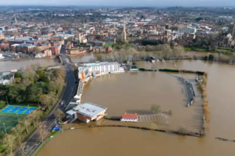
Nearly 100 areas have been issued flooding warnings for Monday, with a yellow weather alert in force for much of southern Wales and England. The Environment Agency estimates that at least 300 properties have been flooded so far, despite efforts to protect over 16,000 homes and businesses.
Andrew Hitchings, flood duty manager at the Environment Agency, stated: "With another band of rain on its way, we need the public to remain vigilant to the risk of flooding." He highlighted significant groundwater risks in Dorset and Wiltshire, river flooding on the Somerset Levels, and probable minor impacts in Worcestershire and Gloucestershire.
Record Rainfall and Unsettled Patterns
January 2026 became the wettest on record for Cornwall in south-west England and County Down in Northern Ireland, according to the Met Office. Many weather stations reported a sense of winter being "stuck on repeat", with 26 stations setting new January rainfall records.
The UK has already seen 89% of the average rainfall expected for meteorological winter (December to February), while England has exceeded it by 11%. Parts of Devon, Cornwall, Worcestershire, Somerset, and West Sussex have recorded more than 30 consecutive days of rain.
Forecast and Continued Disruption
Chief forecaster Neil Armstrong explained: "The past few weeks have felt relentlessly wet, with repeated bands of rain sweeping in from the Atlantic and creating increasingly saturated ground across large parts of the UK." This pattern is driven by a strong, south-shifted jet stream steering low-pressure systems towards the UK.
On Monday, flooding and travel disruption are expected across southern England and Wales, with 10-15mm of rain likely widely and up to 20-30mm in exposed areas. Senior operational meteorologist Simon Partridge added: "The weather is set to remain unsettled throughout the remainder of the week with further spells of wet and windy weather for many areas."
With many areas sensitive to further rainfall, additional warnings are likely as the week progresses. There is currently no sign of any prolonged dry weather for the next seven to ten days, keeping communities on high alert.


