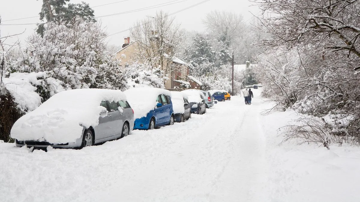
The United Kingdom is preparing for a severe cold snap as new weather maps reveal an impending Arctic blast set to blanket the nation in snow and send temperatures plunging to potentially deadly lows.
Widespread Warnings Issued
The Met Office has issued multiple yellow weather warnings for snow and ice affecting Scotland and northern England from Monday through Thursday. Meanwhile, the UK Health Security Agency has escalated concerns by declaring an amber cold health alert specifically for the North East, North West, and Yorkshire and the Humber regions.
Forecasters are predicting this could be the first significant cold spell of the year, with overnight temperatures potentially dropping to a bone-chilling -10°C in some areas. The combination of extreme cold and strong winds is expected to create dangerous wind chill conditions, making it feel even colder than the actual temperature reading.
Four Days of Arctic Conditions
Fresh weather data from WXCharts illustrates how a four-day freezing period from Tuesday, November 18 to Friday, November 21 will impact vast areas of northern England, Wales, Northern Ireland, and Scotland. The maps indicate that these regions won't just experience passing snow showers - the snow is expected to settle and accumulate, creating potentially hazardous conditions.
Paul Gundersen, Chief Forecaster at the Met Office, provided specific details about the developing situation: "Scattered showers will feed into the North East and far north of mainland Scotland on Monday night, bringing a risk of icy conditions on roads and pavements. An area of rain will reach western Scotland early Tuesday morning, with a risk of this turning to snow as it moves inland."
He further warned that while there's some uncertainty about the exact track and extent, periods of snow are likely over high ground, with accumulations of 2-5cm possible above approximately 150 metres in elevation, and potentially 5-10cm above 400 metres.
Health Risks and Safety Advice
The UK Health Security Agency's amber alert indicates that weather conditions are expected to trigger significant impacts across health and social care services. This includes increased pressure on NHS services, indoor temperatures in hospitals and care homes falling below recommended safe levels, and a concerning rise in fatalities, particularly among those aged 65 and above or individuals with pre-existing health conditions.
The British Heart Foundation is urging particular caution for people with heart conditions during the cold spell. Ruth Goss, Senior Cardiac Nurse at the BHF, explained: "Cold temperatures can increase the risk of heart attacks and strokes, and people with cardiovascular disease are also more at risk of serious illness if they get seasonal respiratory infections like flu."
The BHF recommends several protective measures including maintaining indoor temperatures of at least 18°C, wearing multiple layers of clothing, keeping active indoors, consuming warming meals and healthy hot beverages, and for angina sufferers, wearing a scarf loosely over the mouth and nose to inhale warmer air.
Deputy Chief Forecaster Tom Crabtree identified Wednesday to Friday as likely to be the coldest part of the week, noting that this period "has the greatest potential for impactful weather." Wintry snow showers are expected to extend south through Wednesday and into Thursday, mainly affecting north-facing coastal areas.
The weather is predicted to turn drier from Friday onwards, with milder temperatures and rainfall expected to move into western regions later that day. However, authorities emphasize that people should keep up to date with forecast updates as the situation develops.