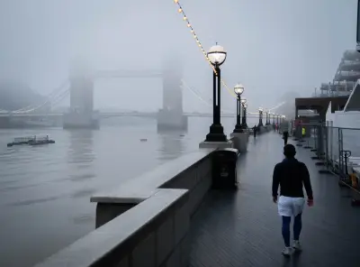
Daytime temperatures could drop as low as -4C next week as millions of Brits face freezing conditions, according to weather forecasting models.
Forecasters have warned that the polar vortex - a ring of powerful winds that keeps freezing air near the North Pole - is weakening, potentially leading to a cold snap in the UK.
According to the Met Office, we could soon face the earliest "major sudden stratospheric warming" event in history. When temperatures rise in the stratosphere, it causes cold Arctic air to rush downward. It can also impact the jet stream and create what is known as a blocking pattern, which keeps cold conditions locked in place over the UK.
Deep Freeze Forecast for Next Week
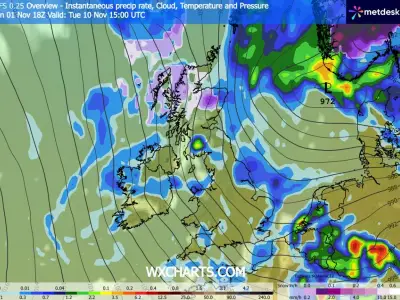
Weather modelling maps now suggest a deep freeze is on the cards next week. The ECMWF model shows temperatures could drop as low as -4C at midday in the north of England on Friday, with -3C in parts of Scotland and -2C in Wales.
Charts for 6pm on Friday suggest temperatures won't improve too much throughout the afternoon. The warmest areas - East Anglia and the far south-east - might reach just 6C, according to the data.
The chilly conditions look set to impact more of England and Wales on Saturday. The ECMWF model shows potential lows of -2C and -3C across Wales, northern England, central England and eastern England at around midday.
Counties Affected
By 6pm, the data once again shows the warmest areas - the far south-west and south-east - might only reach 6C. Temperature anomaly maps for this period show the UK shaded in areas of deep blue and purple. This indicates that temperatures will plunge well below the average for this time of year.
In total, the ECMWF weather model suggests 57 counties across the UK could see daytime temperatures below 0C on Friday and Saturday. The affected areas include numerous counties in England, Scotland, Wales, and Northern Ireland.
Met Office Warns Polar Vortex Is Weakening
Met Office forecaster Marco Petagna said: "At the moment, we've got a warming taking place in the stratosphere. The polar vortex in the stratosphere is starting to weaken."
Mr Petagna added that if winds reverse direction, it would become a "major sudden stratospheric warming" event - potentially the earliest ever recorded. The current earliest major sudden stratospheric warming event occurred on November 28 in 1969 and 2025, but that record looks set to be beaten this year.
The forecaster said: "For the UK, it does increase the chance of cold weather, normally a few weeks down the line, so sort of deeper into November is when we're more likely to see an influence if it does happen.
"It's important to emphasise that there was a major warming event last November, and on that occasion it didn't directly lead to much cold weather in the UK. It doesn't always happen, it just increases the chance of it occurring."