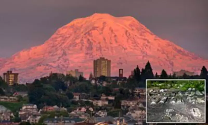
Scientists are warning that three Washington towns could be devastated within minutes if a massive volcanic mudflow suddenly tears down Mount Rainier. Mount Rainier, deemed the most dangerous volcano in the US, threatens more than 60,000 residents living in its lahar danger zone.
What Are Lahars?
Lahars are fast-moving volcanic mudflows capable of obliterating entire communities, even without an eruption, when water rapidly mixes with loose rock, ash and debris on a volcano's slopes. Scientists warned that landslides, heavy rainfall, melting glaciers or even small earthquakes could destabilize part of the volcano, unleashing a torrent of mud, rock and debris down surrounding river valleys.
Former Cascades Volcano Observatory geophysicist Andy Lockhart told Popular Mechanics that Orting, Puyallup and Sumner sit directly in the path of a potential catastrophe that could strike with little or no warning. Researchers are especially worried about Mount Rainier because roughly 150,000 people in Washington's Pierce County live within projected lahar hazard zones.

Why Mount Rainier Is Particularly Dangerous
Rainier, located roughly 60 miles from Seattle, is heavily covered in glaciers and unstable volcanic rock, conditions experts say create the perfect setup for catastrophic mudflows. National Autonomous University of Mexico volcanologist Lizeth Caballero García told Popular Mechanics that lahars are especially dangerous because they are 'complex phenomena that change a lot during transport. They can grow, they can dilute.'
One of the largest lahars in US history occurred thousands of years ago when part of Mount Rainier collapsed, unleashing the massive Osceola Mudflow. Scientists estimate the mudflow carried enough debris to fill roughly 1.5 million Olympic-sized swimming pools more than 220 miles toward Puget Sound, burying parts of what are now the Enumclaw and Kent valleys.
The deadliest modern US lahar struck during the 1980 eruption of Mount St. Helens, when the volcano's collapsing north flank and scorching pyroclastic flows rapidly melted glacial ice. The resulting torrents of mud and debris surged more than 60 miles through the Toutle and Cowlitz river valleys, destroying over 200 homes, 195 miles of roads and 27 bridges.
Preparedness and Drills
The danger of lahars in Washington has become so alarming that emergency officials now conduct massive evacuation drills designed to prepare residents for a disaster many experts believe is inevitable. More than 45,000 students and staff from over 20 schools participated in one of the world's largest lahar evacuation exercises on April 23, practicing evacuations to higher ground while emergency officials tested warning systems. Scientists said the drills underscore a grim reality: another catastrophic lahar in the Pacific Northwest is not considered a distant possibility.
What terrifies researchers most is the possibility of a 'no-notice lahar,' which could happen without an eruption or major earthquake. Everything from landslides and crater lake failures to severe storms and heavy rainfall has triggered deadly lahars around the world. Scientists told Popular Mechanics that a sudden collapse on Rainier's western flank could send a torrent directly toward Orting, Sumner and Puyallup in as little as 30 minutes.
Lockhart admitted the threat deeply unsettles researchers, saying: '[No-notice lahars are] the thing that goes bump in the night. It creeps me out.' Emergency planners fear Orting could face some of the greatest danger because of its limited evacuation routes and growing population. If roads become clogged with traffic during a sudden evacuation, residents could quickly become trapped inside the lahar zone.
Scientists warned that by the time the mudflow reaches populated communities, it could be hundreds of feet high and moving with crushing force. The threat has sparked decades of scientific research aimed at improving warning systems before another disaster strikes.

Monitoring and Research
The Cascades Volcano Observatory has built an extensive network of monitoring stations around Mount Rainier that track seismic activity and detect possible lahars in real time. Researchers have also spent years recreating lahars at a giant experimental flume in Oregon's HJ Andrews Experimental Forest to better understand how the deadly mudflows travel and intensify. The data feeds into computer models that help predict how quickly lahars could hit communities and how much evacuation time residents might have.
But scientists acknowledge there is still enormous uncertainty surrounding no-notice lahars because they can occur without clear warning signs. Researchers are also concerned that climate change could increase the danger by destabilizing glaciers and increasing the likelihood of severe storms capable of triggering sudden flows.