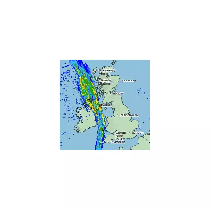
The UK is bracing for a dramatic change in weather as the powerful remnants of Hurricane Lee make their transatlantic journey towards British shores. The Met Office has now revealed the precise timeline for when this ex-hurricane will deliver its punch of heavy rainfall and gusty winds.
From Hurricane to British Downpour
What was once a formidable hurricane in the Atlantic is now transforming into a deep area of low pressure. While it won't hit the UK with hurricane-force strength, this weather system remains potent enough to cause significant disruption. Meteorologists are tracking its path closely as it approaches from the west.
Regional Impact Breakdown
Western Scotland and Northern Ireland will feel the effects first, with the heaviest rain expected through Tuesday. These regions could see rainfall totals reaching 20-30mm in some areas, accompanied by winds gusting up to 45mph along coastal stretches.
Northern England and Wales will experience the system's influence on Wednesday, though conditions are expected to be slightly less severe than further north. Residents should prepare for persistent rain and breezy conditions throughout the day.
Southern England will see the mildest impacts, with mostly cloudy conditions and scattered showers. However, the Met Office cautions that the forecast could change as the system evolves.
What to Expect Day-by-Day
- Tuesday: Heavy rain arrives in Western Scotland and Northern Ireland
- Wednesday: System moves across Northern England and Wales
- Thursday: Conditions gradually improve nationwide
Met Office spokesperson Stephen Dixon emphasized that while this isn't a hurricane warning for the UK, the system still warrants attention. 'We're monitoring the situation closely as the ex-hurricane approaches,' he stated. 'The main impacts will be heavy rain and strong winds, particularly in western areas.'
The timing of this weather event coincides with several outdoor events across the country, prompting organizers to consider contingency plans. Travel disruptions, especially for ferry services and exposed coastal routes, are possible during the peak of the system's intensity.
As autumn properly sets in, this weather pattern serves as a reminder of the UK's vulnerability to Atlantic weather systems. The Met Office continues to update its forecasts and advises the public to stay informed about the latest developments.


