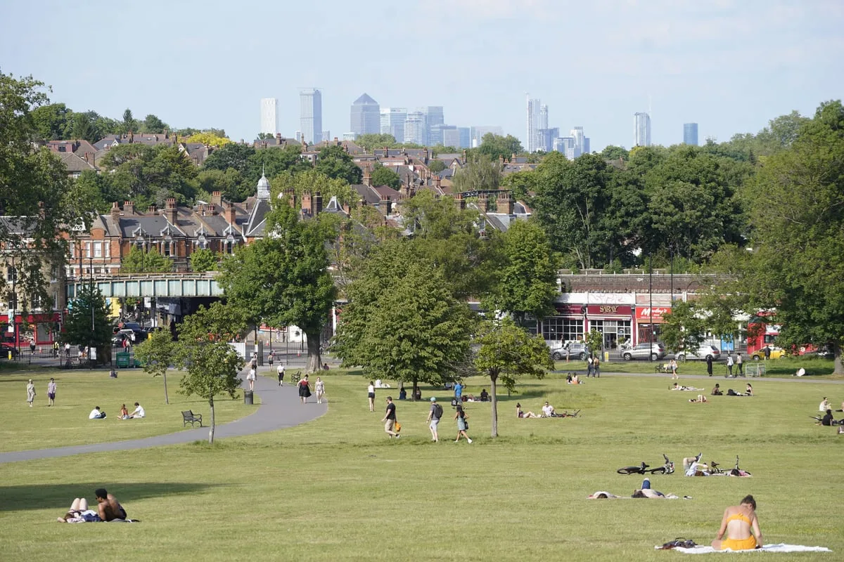
The Met Office has issued a striking forecast predicting that London will experience temperatures soaring to 24C later this week, potentially making the capital hotter than Barcelona. This surge in warmth is expected to follow the blustery conditions brought by Storm Dave, which recently battered the UK with high winds and snow over the Easter weekend.
Warm Weather to Replace Stormy Conditions
According to meteorological experts, the turbulent weather associated with Storm Dave is set to be replaced by sunshine and significantly warmer temperatures across the United Kingdom. London is anticipated to reach highs of 24C on Wednesday, while Manchester could see temperatures around 20C. This represents a dramatic shift from the recent stormy period, which caused travel disruptions and power outages in northern regions.
Record-Breaking Temperatures Expected
If the forecast holds true, the 24C reading in London would surpass the current hottest day of 2026, which was recorded at 20.9C in Gogerddan near Aberystwyth on March 18. This would establish a new annual temperature record for the UK. Furthermore, many parts of the country are expected to be warmer than Barcelona, which is forecast to reach only 19C on both Tuesday and Wednesday of this week.
Detailed Temperature Projections
The Met Office provides specific forecasts for the coming days:
- Tuesday: Sunny conditions are predicted across the UK, with London reaching 20C and Glasgow hitting 19C.
- Wednesday: London could peak at 24C, marking the warmest day so far this year.
- Thursday: A sharp temperature drop is expected, with London forecast to reach only 14C and most of the UK falling below 10C.
Aftermath of Storm Dave
The upcoming warm spell follows severe weather conditions caused by Storm Dave during the Easter weekend. The storm brought substantial snow and powerful winds across northern parts of the UK, resulting in significant travel chaos and leaving numerous homes without electricity. Wind gusts reached extreme levels, including 93mph at Capel Curig in North Wales, 75mph at Emley Moor in West Yorkshire and St Bees Head in Cumbria, and 73mph at Buchan in Aberdeenshire.
In Scotland, some properties experienced power outages due to the high winds overnight. Scottish and Southern Electricity Networks (SSEN) deployed fault response teams to restore electricity to affected customers, particularly in areas such as Skye, Caithness, and coastal parts of Aberdeenshire.
Met Office Weather Forecast Summary
The Met Office has provided a detailed outlook for the upcoming period:
Today
A chilly but bright start is expected, with plenty of sunny spells throughout the day. Cloudier skies may appear at times in western regions, and a few splashes of rain are possible for Northern Ireland and northwest Scotland. Breezy conditions will persist in the west, though many areas will feel warmer.
Tonight
The evening should be fine, but temperatures will drop again overnight under clear skies, potentially leading to patchy frost in eastern areas. A few showers may still occur in the far northwest.
Tuesday
Most places will remain dry with sunny spells. However, cloud and outbreaks of rain are expected to move across Northern Ireland and western Scotland during the afternoon. Breezy conditions will continue in the west, with warm feelings in the sunshine.
Outlook for Wednesday to Friday
Wednesday is predicted to be mostly dry with spells of warm sunshine. From Thursday onwards, conditions will turn fresher for all regions, with showers or longer spells of rain. The northwest could experience very windy conditions by Friday, indicating another potential shift in weather patterns.
This forecast highlights the UK's volatile spring weather, transitioning from stormy conditions to a brief heatwave before returning to cooler temperatures. Residents are advised to enjoy the warm spell while it lasts, as the Met Office indicates it will be short-lived.


