
The Bureau of Meteorology has officially declared that the La Niña climate driver is active over the Pacific, prompting urgent warnings for Australians to prepare for potential severe weather this summer.
What La Niña Means for Australia
Meteorologists confirmed the system's arrival last week, noting clear signs that the tropical Pacific ocean and atmosphere are now reinforcing the La Niña pattern. This weather phenomenon typically brings cooler, wetter conditions to large parts of the country and heightens the risk of tropical cyclones and monsoons.
In contrast to the drying effects of El Niño, La Niña is notorious for delivering above-average, often torrential rainfall. Atmospheric indicators, including trade winds, pressure, and cloud patterns over the equatorial central Pacific, all show consistent signs of the event.

Lessons from a Devastating Predecessor
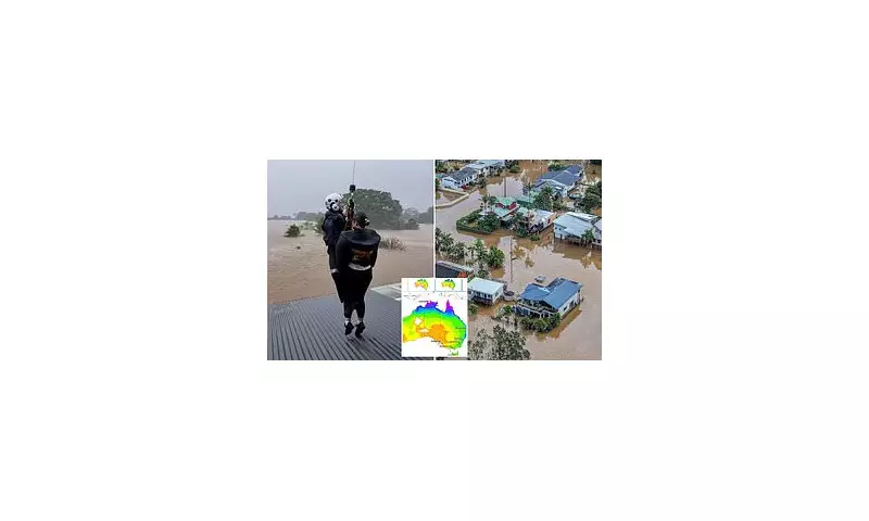
The memory of the last La Niña remains fresh and traumatic. It persisted from 2020 until March 2023, triggering record-breaking downpours and catastrophic flooding, particularly in New South Wales and southeast Queensland.
The 2022 eastern Australia floods were especially harrowing, stretching from Sydney to the mid-north coast of NSW and up to Brisbane. The disaster claimed two dozen lives, forced hundreds of schools to close, and submerged more than 3,000 homes in the regional city of Lismore alone.
A Mixed Forecast with Serious Risks
In a partial relief, the Bureau predicts this La Niña will be 'weak and short-lived'. Its summer forecast suggests below-average rainfall is likely for western and eastern inland areas.
However, the outlook is complex and carries significant dangers. The Bureau also warns of wildly varying conditions, an increased bushfire risk for parts of New South Wales, Victoria, and Western Australia, and warmer-than-average days and nights with a heightened threat of extreme heat.
NSW State Emergency Service Assistant Commissioner, Sean Kearns, has urged the public to avoid complacency. 'It is important to know your storm and flooding risk, have a plan in place, get your home ready, be aware of what you will do if disaster strikes, and look out for one another,' he said.
He advised people to stay informed via local warnings and the Hazards Near Me app, issuing a critical reminder: 'Please steer clear of floodwater. If you encounter a flooded road, turn around and find an alternative route.'


