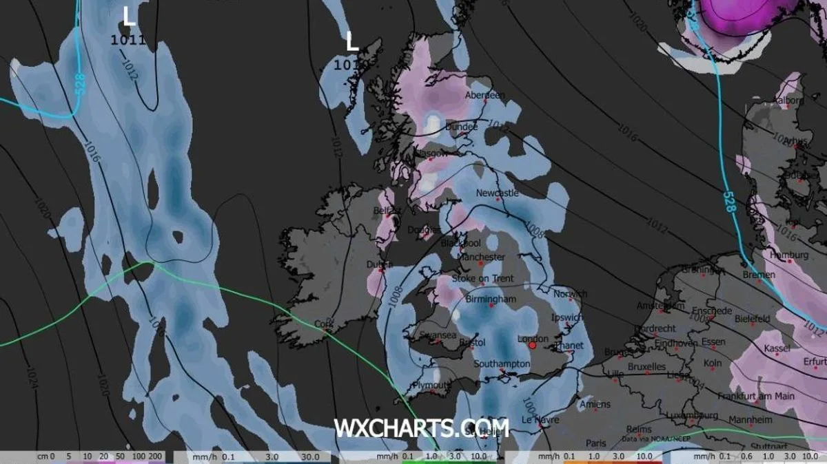
UK Snow Forecast: 21-Hour Arctic Blizzard Set to Bury Britain in Mid-December
21-Hour Arctic Blizzard Forecast to Hit UK in December

Britain is bracing for a significant winter onslaught as new weather modelling indicates a prolonged Arctic blizzard could blanket parts of the country in snow for up to 21 hours. The event, currently forecast to begin in the early hours of December 15, is predicted to impact all four home nations.

Timeline of the Snowfall Event

According to advanced GFS weather modelling maps, the snowfall will first arrive in Scotland in the early morning darkness of December 15. From there, the system is expected to march slowly southwards, bringing disruptive weather to Northern Ireland, Wales, and parts of England throughout the day.

By 9am on December 15, the most intense snowfall is projected to be over southern Scotland, specifically the Galloway Forest Park area. Simultaneously, heavy flurries are expected in the Lake District and the Pennines in northern England. Lighter snow is also a possibility for parts of Northern Ireland at this time.

Peak Intensity and National Impact

The afternoon is set to bring the snow further south. By 3pm, heavy snow looks likely to fall across North Wales, with Snowdonia expected to bear the brunt. Ireland is also in line for flurries, with the possibility of snow reaching the capital, Dublin.

Areas that manage to avoid the snow are not in the clear, as they are likely to face persistent rain instead. The weather front is expected to bring widespread downpours to most of central and northern England throughout the day.

After a full day of wintry conditions, snow coverage maps for 9pm on December 15 reveal the potential extent of the accumulation. Following the 21-hour event, snow is forecast to be settled on the ground across North Wales, Northern Ireland, northern England, and almost all of Scotland.

Longer-Term Forecast and Meteorological Uncertainty

Looking beyond this specific event, forecasters express considerable uncertainty for the latter half of December. The BBC Weather outlook for December 15 to 28 cites "very low confidence" due to complex disturbances in the upper atmosphere.

Their forecast suggests high pressure could become more prevalent near the UK, leading to drier conditions and an increased risk of frost and fog in the run-up to Christmas. However, they also note a risk that high pressure building at higher latitudes could eventually funnel colder outbreaks to the UK later in the month.

Echoing this cautious outlook, the Met Office forecast for December 16 to 30 indicates a greater chance of high-pressure spells bringing drier weather compared to early December. They state: "Hill snow is also a possibility, mainly in the north." While near or slightly above-average temperatures are deemed most likely, the Met Office acknowledges that some colder spells remain possible, especially if any prolonged settled weather develops.

Residents across the UK are advised to monitor the latest forecasts and travel updates as the potential for significant mid-December snow and ice becomes clearer.