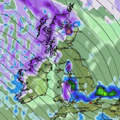
A significant chilly spell is sweeping across the UK, bringing the first widespread snowfall of the season to parts of the country. Weather maps have turned white, indicating that up to 10 towns could see a dusting of snow as early as Friday evening, with temperatures set to plummet below freezing.
Which Areas Will See Snow?
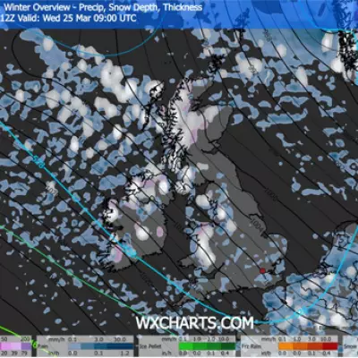
According to detailed weather maps from WXCharts, which utilise MetDesk data, the snowfall is expected to hit around 6pm on Friday. The towns and cities most likely to experience a scattering of snow are:
- Stoke-on-Trent
- Crewe
- Macclesfield
- Sheffield
- Carlisle
- Dumfries
- Hawick
- Ayr
- Stirling
- Perth
While these areas prepare for wintry conditions, forecasters predict a wet and miserable spell for many other regions, with rain expected across most of the country except for parts of Northern Ireland, the Highlands, and the South West.
Met Office Warnings and Travel Disruption
The Met Office has issued a yellow weather warning for Friday, covering much of Sussex and Kent. This warning is in place from midnight until 9am, with the public advised to expect slower journey times and potential delays on the roads during the morning commute.
Chief Meteorologist, Matthew Lehnert, stated: "The UK will see further unsettled weather through the weekend and into next week. After a chilly start with the chance of some icy patches and fog in the southeast of England, wind and rain will move across the UK through Friday. It’ll be an unpleasant evening rush hour so do leave extra time if you’re out on the roads."
He further warned that the highest rainfall totals from Friday into Saturday will be over high ground in south Wales, southwest England, Cumbria, southwest Scotland and Northern Ireland, with 20-30 mm of rain likely. This raises concerns about localised flooding, especially in already saturated western areas.
Looking Ahead to Next Week
The unsettled pattern is set to continue. The Met Office has indicated the potential for a disruptive spell of weather early next week, with a deep area of low pressure expected to bring heavy rain and strong winds on Monday and Tuesday.
Deputy Chief Meteorologist, Steven Keates, advised: "People should keep up to date with the forecast through the weekend, and keep an eye out for severe weather warnings that may be issued for this area of low pressure."
By the early hours of Saturday morning, the main band of snow and rain is forecast to have passed over England, with some lingering precipitation in Wales and the Scottish Highlands. Further snow showers are also possible just south of Inverness and in the central Highlands at that time.


