
The United Kingdom is facing a dramatic weather shift, with an Arctic blast forecast to bring snow and freezing temperatures just as emergency services deal with the aftermath of Storm Claudia.
Major Incident Declared After Devastating Floods
A major incident was declared in parts of Wales after the storm, named by the Spanish meteorological service, hit the UK on Friday. The impact was particularly severe in the town of Monmouth, in south-east Wales, where dozens of people had to be rescued or evacuated from their homes.
This occurred after the River Monnow burst its banks, causing severe flooding. The situation was described as "extremely bad" by Peter Fox, the Welsh Conservative Member of the Senedd for Monmouth, who noted he hadn't seen flooding so severe in the area for about 40 years.

Rainfall figures highlighted the intensity of the storm. The Met Office reported that 119.6 mm of rain was recorded at a Natural Resources Wales rain gauge at Tafalog in Gwent in the 12 hours to 6am on Saturday. Meanwhile, Suckley in Worcestershire saw 80.6mm over the same period.
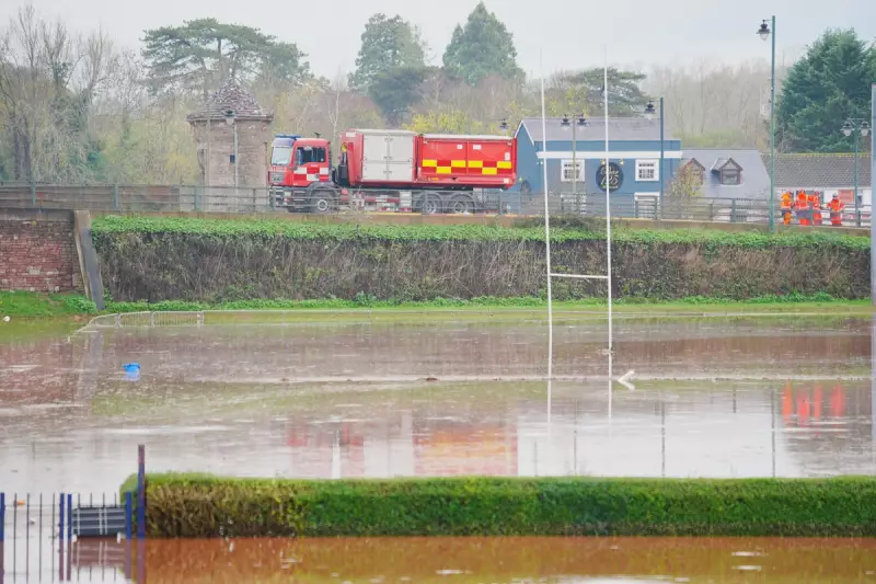
Emergency Services Mobilise Amid Challenging Conditions
The flooding created extremely difficult conditions for rescue workers. South Wales Fire and Rescue Service reported that fast-moving water and blocked routes made operations "challenging."
A multi-agency response was launched, involving Gwent Police, the Welsh Ambulance Service, the Severn Area Rescue Association (SARA), Mountain Rescue, the Coastguard, and fire services from neighbouring areas.
In response to the ongoing danger, Natural Resources Wales (NRW) imposed four severe flood warnings, indicating a potential danger to life. The affected areas include the River Monnow at Watery Lane, Over Monnow; the River Wye at Monmouth; the River Monnow at Forge Road and Osbaston; and the River Monnow at Skenfrith.
Authorities urged the public to avoid affected areas. Monmouthshire County Council advised people to avoid unnecessary journeys into town due to "the severity of the flooding" and the ongoing emergency operation.
Arctic Cold Snap Set to Grip the Nation
As the cleanup from the floods gets underway, a new weather threat is emerging. The Met Office has warned that a cold snap originating from the Arctic is expected to sweep across the UK in the coming days.
Deputy Chief Meteorologist Dan Holley stated: "As Storm Claudia retreats to the south, high pressure to the north west will drive a cold northerly flow from the Arctic across the UK. This will bring much colder conditions than of late and, whilst generally drier than recent days, there will also be a risk of wintry hazards, such as snow and ice."
The forecast predicts widespread frosts with temperatures potentially plunging as low as -7°C in some areas next week. Daytime temperatures are expected to remain in single figures across the country, compounded by a brisk northerly wind that will create "a marked wind chill."
In preparation, the UK Health Security Agency (UKHSA) has issued a cold weather alert for the East Midlands, West Midlands, North East, North West, and Yorkshire and The Humber. This alert is active from 8am on Monday until 8am next Friday.
Travel disruption is also expected to continue. National Rail has advised passengers in England and Wales to check their journeys, as some services remain affected by the earlier storm and the impending cold weather.


