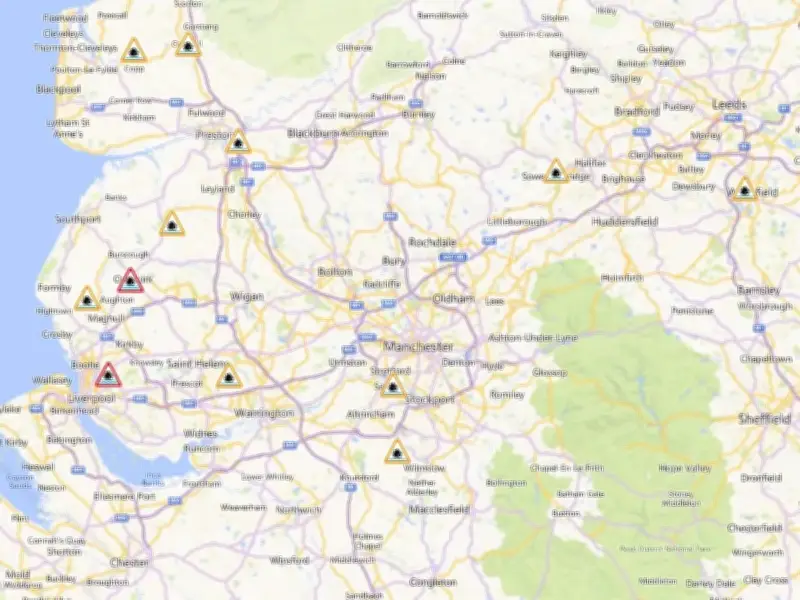
Two flood alerts are currently in place across Greater Manchester following heavy rain and strong winds that have affected the region over the past week, marking the start of meteorological autumn.
The alerts cover the Middle River Mersey catchment, including areas near Bramhall, Stockport, Sale, Altrincham and Urmston, and the River Bollin catchment, including Knutsford, Wilmslow, Macclesfield and Bollington. In both cases, rising river levels overnight may lead to flooding from the morning of September 4, 2026.
Flood alert details
The alert for the Middle River Mersey catchment said: "Locations most affected will be low lying land and roads around Micker, Cringle, Sinderland and Poynton Brooks and their tributaries rainfall overnight is expected to cause river levels to increase from Friday morning onwards, peaking around 10:00am 4th September. Flooding is expected to worsen until this time. Flood warnings ARE NOT currently expected to be issued."

The alert for the River Bollin catchment said: "Locations most affected will be low lying land and roads around the Rivers Bollin, Dean and Pedley, Birkin and Mobberley Brooks and their tributaries river levels are expected to increase peaking at 10am. Flood Warnings are not currently expected to be issued."
In addition, two flood warnings are in place in Lancashire, meaning residents should expect flooding, at Sandy Brook and Hurlston Brook at Ormskirk and Tue Brook at Clubmoor.
Weekend weather forecast
The Met Office forecast for Greater Manchester shows a sunny and rainy day on Friday (September 4) with highs of 19C, followed by a similar day on Saturday (September 5). By Sunday (September 6), temperatures will rise to highs of 26C in Manchester, before dropping back to 19C on Monday (September 7).
Weather maps show the peak of the heat hitting around 4pm in the afternoon, when temperatures could reach as high as 28C in London and some surrounding areas.
The forecast for north west England between Saturday and Monday reads: "Saturday looks mainly dry with some sunshine and fairly gentle winds. Turning wet and windy from the northwest on Sunday, ahead of brighter skies again on Monday."
The long-range forecast, covering September 8 to 17, warns of further "unsettled periods". The forecast reads: "Overall, a fairly unsettled period is likely to begin this period with many places seeing showers or longer spells of rain at times, interspersed by drier periods. Rain is likely be most frequent across northern and western areas, while the south and east are more likely to see longer drier interludes. There is also the potential for some strong and gusty winds at times, particularly in the northwest."
It continues: "Temperatures are likely to be near average. However, further into mid-September, more settled weather is looking increasingly likely, bringing drier conditions with lighter winds and perhaps some warmer conditions too."
This comes as the UK is being told to prepare for a "supersized" El Niño, with the Met Office saying that this year will see the development of the largest El Niño in living memory.