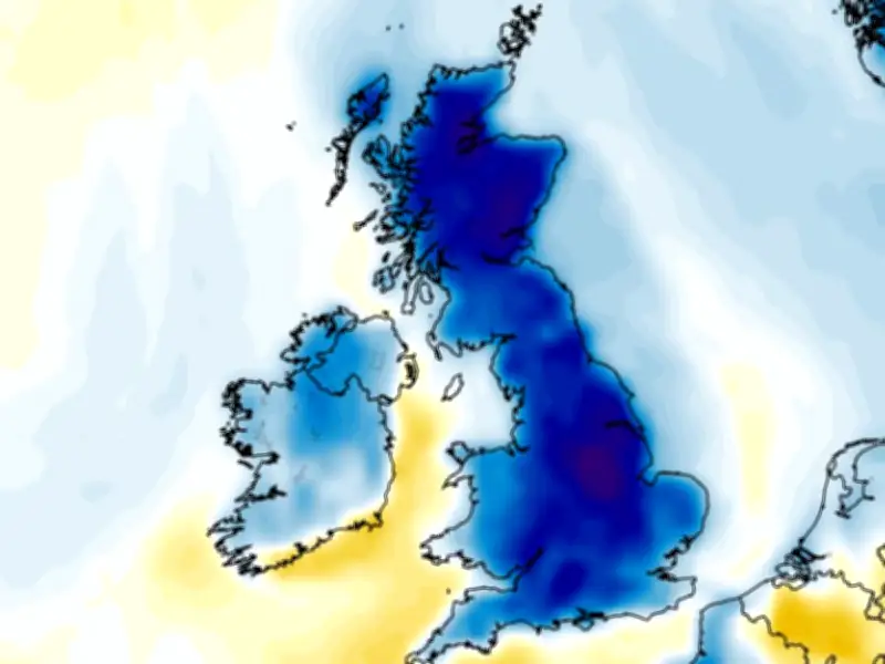
The UK's third major heatwave of the year is expected to peak at 36C today, but weather models indicate a sharp cooldown within days, with some areas waking up to just 4C on July 19. According to the GFS weather model, temperatures at 6am on July 19 will fall into single digits across 81 counties, affecting much of England, Scotland, Wales, and Northern Ireland.
Heatwave Peak and Health Alerts
The Met Office forecast issued this morning says temperatures should reach 36C in southern areas and 34C in northern regions today, with similar highs of 35C and 33C respectively on Saturday. Heat health alerts remain in place across England, and people have been advised to stay hydrated as conditions could have severe health impacts. Although the Met Office has not issued weather warnings, an isolated thunderstorm may develop this afternoon, particularly in Scotland where cloudier conditions and showery rain are expected.
Dramatic Temperature Drop Forecast
The GFS weather model shows that by July 19, the mercury will plunge well below average. At 6am, most of the UK will see temperatures below 10C, with only eastern and south-west England reaching double digits. Scotland could experience lows of 4C. By midday, highs will only reach 14C in eastern England, with 10C to 12C widely across the country—a stark contrast to the recent 30C days. Similar conditions are expected on July 20, with southern areas reaching just 15C at midday.
Temperature anomaly maps for this period show the UK shaded in deep blue, indicating temperatures well below the seasonal average. The maps suggest 81 counties will see single-digit temperatures on the morning of July 19.
Counties Affected by Single-Digit Temperatures
England: Berkshire, Bristol, Buckinghamshire, Cheshire, Cumberland, Derbyshire, Dorset, County Durham, Essex, Gloucestershire, Hampshire, Herefordshire, Hertfordshire, Kent, Lancashire, Leicestershire, Lincolnshire, Northamptonshire, Northumberland, Nottinghamshire, Oxfordshire, Rutland, Shropshire, Somerset, Staffordshire, Sussex, Warwickshire, Westmorland, Wiltshire, Worcestershire.
Scotland: Aberdeenshire, Angus, Argyll, Ayrshire, Banffshire, Berwickshire, Bute, Caithness, Clackmannanshire, Cromartyshire, Dumfriesshire, Dunbartonshire, East Lothian, Fife, Inverness-shire, Kincardineshire, Kinross-shire, Kirkcudbrightshire, Lanarkshire, Midlothian, Morayshire, Nairnshire, Orkney, Peeblesshire, Perthshire, Renfrewshire, Ross-shire, Roxburghshire, Selkirkshire, Shetland, Stirlingshire, Sutherland, West Lothian, Wigtownshire.
Northern Ireland: Antrim, Armagh, Down, Fermanagh, Londonderry, Tyrone.
Wales: Brecknockshire, Caernarfonshire, Cardiganshire, Carmarthenshire, Denbighshire, Flintshire, Glamorgan, Merionethshire, Monmouthshire, Montgomeryshire, Radnorshire.
Met Office's Latest Forecast
The Met Office stated: "[Today will be] cloudier for parts of Scotland with the risk of showery rain in the north, which may turn heavy and thundery later. An isolated late afternoon thunderstorm may also develop elsewhere." Overnight, any thunderstorms will ease, with most areas having a fine evening, though Scotland remains largely cloudy with a few spots of rain. Saturday will be rather cloudy across Scotland with showery rain, while elsewhere it will be generally sunny but with a risk of low cloud along eastern coasts of England. It will be hot in the west and cooler in the east.