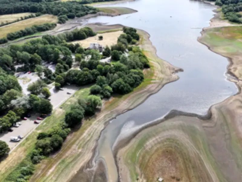
After weeks of widespread heatwaves and dry weather, large parts of England and all of Wales are in a drought. But with rainfall finally on the forecast, could this be enough to end the drought?
Drought conditions across England and Wales
East Anglia, Hertfordshire and North London, Thames, Devon, Cornwall and Isles of Scilly, West Midlands, Wessex, Kent and South London, Solent and South Downs, East Midlands, Lincolnshire and Northamptonshire are all in drought conditions, data from the Environment Agency shows.
Greater Manchester - along with North East, Yorkshire, Cumbria and Lancashire, Merseyside and Cheshire - remain in prolonged dry weather, which is the category before a drought.

Wessex Water became the latest utility to announce a hosepipe ban on Monday, August 17, after weeks of heatwaves and dry weather have left many areas facing water shortages. There are now more than 27 million people across England facing water restrictions.
Affinity Water, Anglian Water, Cambridge Water, Essex and Suffolk Water, Southern Water, South East Water, South West Water, and Thames Water are all imposing water restrictions due to the lack of rainfall.
Rain forecast but not enough
Following the fifth widespread UK heatwave last week - which saw temperatures surpass 38C at its peak - temperatures have cooled this week, with the Met Office finally forecasting some significant rainfall.
Monday saw rain arriving into Northern Ireland and western Scotland before spreading eastwards through the afternoon and evening. Some of this rain could become locally heavy, particularly across western areas, the Met Office says. Then showers and longer outbreaks of rain will continue across many northern parts on Tuesday.
"For areas that have seen little or no measurable rain for many weeks, this will certainly be a noticeable change, even if totals remain modest," the Met Office forecast reads.
Then, the conditions will turn "increasingly unsettled" on Wednesday, the UK weather agency warns, with "frequent showers" across Northern Ireland, Scotland and parts of northern England, which could be heavy enough to produce hail and thunder.
Thursday is expected to be one of the most unsettled days of the week, with "heavy and potentially thundery showers" expected across many parts of the UK, with England and Wales most likely to see the most intense downpours.
"Some places could experience brief periods of very heavy rain, hail and isolated thunderstorms," the Met Office says.
The theme continues onto Friday, with England and Wales seeing the greatest concentration of showers which could be "heavy and thundery".
Impact on the drought
Although rainfall is on the forecast, the Met Office has said they remain cautious about the impact it will have.
"Many of the wettest periods this week are expected to come in the form of showers rather than prolonged, steady rain," the Met Office says. "Showers can be highly variable, with some places receiving significant amounts of rain while neighbouring locations see very little. Heavy downpours can also run off very dry ground rather than soaking deeply into the soil."
It continues: "The scale of the recent dry spell is illustrated by the number of locations still recording exceptionally long runs without significant rainfall. Wisley in Surrey has recorded 61 consecutive dry days, while Heathrow and Odiham have each gone 55 days without meaningful rain. Several other locations across southern England have recorded dry spells lasting more than six weeks."
The Met Office concludes that a few days of showers are "unlikely to completely reverse the effects of such prolonged dryness".