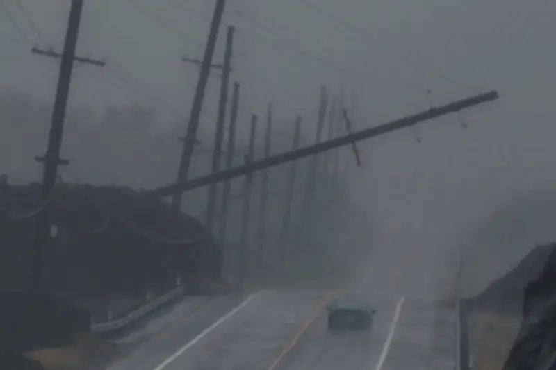
Hurricane Nolo is the latest storm to menace the Hawaiian islands, marking the third major tropical storm to threaten the region in recent months. Nolo strengthened to a hurricane on Thursday night and is expected to batter the islands with rain and high surf.
Hurricanes Lala in August and Lowell in early September flooded homes and roads, downed trees, and toppled electricity lines across the islands. Already, more than 500 homes have been damaged or destroyed as Nolo threatens to unleash downpours that could measure in feet instead of inches.
Why Hawaii is in the bullseye
Despite stretching across roughly 1,500 miles in the central north Pacific Ocean, Hawaii typically avoids the worst effects from hurricanes. The island chain so often dodges direct hits that it has been joked they have a force field around them. But this year has seen an unusual amount of severe storms.
“An event of this magnitude is somewhat rare,” Michael Brennan, director of the National Hurricane Center, said during a broadcast discussion as Lowell swirled closer last month. He added that Hawaii has not had a direct hurricane landfall since Iniki in 1992, which unleashed 145 mile-per-hour winds as it tore through Kauai, destroying or damaging roughly 70% of the island’s homes and businesses.
Warm oceans and El Niño
It is not luck or a force field that typically protects the islands, but location, according to Dr Nicholas Grondin, assistant professor of environmental science at the University of Tampa. Among the most isolated chains of islands on Earth, Hawaii is a small target in the vast open ocean, Grondin explained in an editorial published by the Conversation. Most approaching storms must also pass over cooler water temperatures to the east of the islands, which helps calm them.
“Without warm oceans to provide fuel, hurricanes tend to weaken and fizzle out as they approach the islands,” Grondin said. Sea-surface temperatures in the tropical Pacific are, however, exceptionally warm this year due to El Niño. The climate phenomenon typically limits hurricane activity in the Atlantic and enhances the development and strength of storms in the Pacific. El Niño has already developed but is expected to strengthen through the coming months, and forecasters have warned there is a high probability it will reach a historic intensity.
El Niño has caused hurricanes to form further to the south and west this year, according to Matthew Rosencrans, National Oceanic and Atmospheric Administration’s lead forecaster for the seasonal hurricane outlook, which “puts them in a place where they could make that westward run towards the Hawaiian islands.” It also makes for a lagging storm season, with September and October far busier in El Niño years.
Climate crisis adds fuel
The climate crisis has also played a part in strengthening the storms, with El Niño effects layered on top of warming trends. “The oceans are absorbing 92% of the excess heat to the climate system from the addition of heat-trapping pollutants to the atmosphere,” Union of Concerned Scientists climate scientist Dr Marc Alessi said in a thread shared on Bluesky. According to Alessi, the energy added to oceans over just the last year is on par with roughly 12 Hiroshima bombs of heat released every second.
“For the next year, we can expect to see precipitation and other weather extremes unlike anything we’ve seen before,” he said. For Pacific storms, Rosencrans said, it means they may carry more moisture and produce stronger winds.
As efforts begin to clear debris and repair roads and infrastructure damaged during Lowell, emergency management officials must continue keeping close watch on the waters for the next big storm. “They just need to reset and regard any potential upcoming impacts,” Rosencrans said. “The season is not over – there is still a long bit to go.”