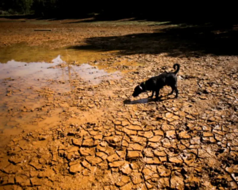
This year's El Niño, arriving less than two years after the last one, has already broken temperature records. To understand what is happening, the Guardian interviewed Prof Mat Collins, a climate scientist at the University of Exeter, an expert on the dynamics of the El Niño southern oscillation.
What is El Niño?
El Niño is a natural climate pattern that affects large parts of the world, often bringing higher temperatures, more droughts and floods. It occurs when the normally cool, dry east Pacific becomes warmer and wetter, shifting rainfall patterns in the tropical Pacific and with other impacts far beyond that. It usually occurs every three to seven years, but is very erratic. The last one was in 2023-24.
El Niño and Global Heating
The relationship between El Niños and human-caused global heating is best described as two separate things that layer on top of each other. If drought conditions already exist as a result of global warming, an El Niño is going to exacerbate that. The harder question is how they interact with each other. With models, hundreds of years of simulations can be used to work that out, but the observational record lacks the data, although some palaeoclimate reconstructions suggest the present day frequency of El Niño is quite unusual.
This year's El Niño has already broken records and could be on course to be the strongest in a thousand years. The sea surface temperature of the El Niño region of the Pacific has already reached the previous 2015 high of 3C above average, which is almost unthinkable. It still hasn't peaked, so the full extent won't be known until the end of the year.
Measuring the size in comparison with previous El Niños is difficult because the baseline of sea surface temperatures in the eastern tropical Pacific is steadily rising due to global warming. There are two things happening – human-driven climate change and the natural variability of El Niño – and it is not easy to say how much each is contributing to the record high ocean temperatures. Together, they make extremes more likely.
Global Impacts and Forecasts
Currently temperatures in the eastern Pacific are on course to be 4C above the average, which is far beyond anything seen before. If that trend continues, an incredible El Niño event could be seen. Around the peak of the El Niño, there are likely to be more wildfires in Indonesia and drought in the Amazon rainforest. The Indian monsoon has already been weakened because of El Niño. Temperatures are likely to be higher around the Pacific Rim and as far away as the UK. Meteorologists suggest the UK will see a wetter winter and autumn and possibly a drier, colder spring, though UK weather is so variable.
The recent high temperatures in the UK and the wildfires in Europe, Canada and the US are not thought to be worsened by El Niño because they came so soon after the onset, and there is normally a lag. Those conditions are more likely to be a signal of global warming, combined with persistent anticyclonic circulation patterns that cause weather systems to be settled for long periods.
Future El Niños and Mitigation
Several scientific papers, including by Prof Collins, suggest there is a possibility that human-caused climate change is making El Niños more frequent and intense. One paper suggested the signal will emerge first in terms of rainfall patterns, so a clearer picture may be available in the next decade. James Hansen argues that human-driven climate change is likely behind the abnormal strength of this El Niño, a hypothesis that is plausible but hard to prove.
Climate change makes it more likely El Niños will be fiercer, but that is still not certain. The impact of an El Niño depends on the temperature difference with other oceans, such as the Atlantic and the Indian. The rainfall goes where the warmest water is found. If that warmth is distributed, so will be the rainfall. If that warmth is concentrated in one ocean, then the rainfall will shift around so it is more intense in that basin.
The huge El Niño may be a sign that the world's oceans are transferring heat to the atmosphere, but it is just part of a cycle. There is still plenty of cold water in the world that can be heated up, so there may not be a physical limit. The impacts of El Niños are certainly going to be greater, and if models are to be believed, the rainfall response is also going to be bigger. There will be bigger and more impactful El Niños over the coming decades.
Knowledge can help reduce the risks. Forecast systems can confidently predict these things six to nine months ahead, allowing preparation. Farmers in Latin America can be told to plant different crops, and governments in south-east Asia can be warned to think about their infrastructure and strengthen defences against wildfires. The main response should be to reduce greenhouse gases, but there may also be options for geoengineering, such as changing the properties of clouds in the eastern Pacific, which may influence the scale and timing of El Niño events. One paper suggests a big event could be terminated by creating lots of clouds, which would cool the surface of the ocean in the east Pacific.
The effectiveness of such geoengineering is not yet clear because the heat comes from the deep ocean. Even if an event is prevented in one year, it may come back the next. The prospect of even more impactful El Niños is worrying because El Niño causes huge disruptions to agriculture and the global economy. This is very bad for people, particularly in poorer countries who are already suffering the consequences of climate change and now get an El Niño event on top of that. Good predictions are available now, and it is important to maintain that capability, for example collecting real-time data from the Pacific Ocean, so that we can be forewarned.