Part of Brighton's historic West Pier has collapsed into the sea, and 31,000 homes have been left without power as Storm Austen sweeps across the South West. The storm, the first named storm of the season, has brought severe conditions to parts of the region, with further disruption expected over the weekend.
West Pier Suffers More Damage
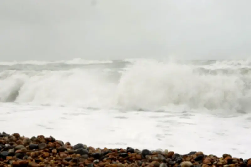
Social media videos circulated on Friday showed part of Brighton's West Pier falling into the sea as it was buffeted by tall stormy waves. The structure in Brighton, East Sussex, was set ablaze in 2003, and its skeletal remains have become a feature of the seaside town ever since.
Professor Fred Grey, an honorary historian at the West Pier Trust, said: "Storm Austen has caused more of Brighton's West Pier to collapse into the sea. Ever since the two devastating arson attacks in 2003, the West Pier has been whittled away by nature. All ruins are alive and ever-changing, and this is true of the West Pier."
He added: "Everyone should stay at a safe distance and watch the battle between pier and the elements. We don't know when the pier will eventually disappear beneath the waves, but disappear it will."
Power Outages and Travel Disruption
As of 3pm, more than 31,000 homes were without power in the South West, according to a spokesperson for the National Grid. They also confirmed that engineers had restored power to more than 52,000 properties since Storm Austen began.
A gust of 76mph was recorded at St Mary's Airport on the Isles of Scilly on Friday morning. Some flights have been cancelled, including a number by Loganair throughout Friday, with services to and from Jersey, Bristol, Exeter and Southampton affected. There were seven cancellations at Gatwick Airport due to weather conditions in the Channel Islands.
Cornwall County Council's website listed more than 20 schools which had closed for the day, while more than 50 opened late. The council said its highways teams were dealing with 100 incidents across the county, with most involving fallen trees and branches.
Government Response and Warnings
The Prime Minister has warned that the UK could face "a winter of greater flooding" and said we are living in a world where "unexpected events" are "more and more common". He told BBC Radio 5's Matt Chorley that the Government would do all it could to help people in the South West.
Andy Burnham, speaking at a summit organised to learn from the summer's record wildfires, told reporters: "No, we are having the conversation with people about being better prepared because we're living in a world where unexpected events seem to be becoming more and more common. Obviously weather events – and we're in a situation today where the UK is facing storms, and obviously we feel for the people without power in Cornwall right now – it is just having those supplies in the house to get you through those moments."
The Met Office had issued an amber warning for wind, covering Cornwall, Devon and the Isles of Scilly, which was in effect from 1am until 10am on Friday. Forecasters have now issued an amber warning for wind from Storm Boelo, which is in place for 24 hours from 9pm on Saturday covering Scotland, the north coast of Northern Ireland, and Cumbria and Northumberland in the north of England.
Further Warnings and Travel Advice
Yellow weather warnings have been issued for the whole of mainland Scotland, the Western Isles, Orkney and the far north of England from 12pm on Saturday to 9pm on Sunday. There will be "widespread gusts" of 55-65mph widely, with these reaching up to 70-80mph in more exposed coastal locations, the Met Office added.
A separate yellow warning for wind, covering Northern Ireland from 10am on Saturday to 12pm on Sunday, predicts gusts of 50-60mph, with up to 65-75mph in exposed regions. Storm Boelo is a separate low pressure system to Storm Austen, which is due to clear eastwards into the North Sea through Friday.
Network Rail Scotland said trains will be slowed down on Friday and over the weekend to keep people safe in the areas expected to see the heaviest rain. Early on Friday, Southern Rail announced a lightning strike at Normans Bay prevented trains from stopping at the station. National Rail said in a post on X that the weather warning meant fewer trains would call at Ryde Pier Head until 6pm on Friday, and some services between Leeds and York via Harrogate will not stop at Weeton or Headingley, while trains between York and Blackpool North will skip New Pudsey.
Amy Webb, chief operating officer at National Grid Electricity Distribution, said: "We know how difficult it is to be without power, particularly during severe weather. Our engineers are out across the affected areas, working to repair the damage and get customers back on supply as quickly and safely as possible. We're grateful for their patience while that work continues. If you see a fallen power line, damaged pole or other damage to our equipment, please stay well clear and call 105 straight away."
Forecasters said strong winds will be combined with spells of heavy rain, though gusts in the area will gradually ease over Friday. Rain will be heaviest in southern and eastern Scotland, where a yellow weather warning has been issued from 7am to midnight on Friday, with accumulations of 20-40mm expected and 60-80mm possible in some locations.