
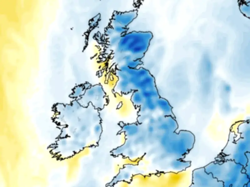
Weather forecasting data suggests this summer’s heatwaves could soon finally make way for a cooler spell as daytime temperatures drop below 10C in England, Scotland, Northern Ireland and Wales.
Cooler spell expected from next week
From the middle of next week and into the following week, temperature anomaly maps show the UK shaded in areas of blue. This indicates that temperatures could finally drop below the seasonal average - a far cry from the scorching 38C heat we should see today.
For next Wednesday, the ECMWF weather model shows midday temperatures might reach just 15C in the south-east of England, 14C in the Midlands, 14C in Wales, and 11C in Scotland - possibly dropping as low as 6C in northern parts of Scotland.
Peak temperatures still below average
While at peak times in the afternoon on Wednesday, the south-east might reach just 19C, with 18C in South Wales and 15C in Northern Ireland.
For Sunday August 23, midday temperatures could drop as low as 4C in the far north of Scotland, only peaking at 14C in the far south-east of England, according to ECMWF model data. They could rise to 19C in the afternoon in southern areas - but this is still way below the seasonal average.
Further cool days forecast
And similar conditions look to be on the cards on Tuesday August 25. The ECMWF model shows minimum possible temperatures of 4C in Scotland, 6C in Wales, 7C in Northern Ireland and 8C in northern parts of England at around midday. By the afternoon, peak temperatures could reach around 20C in England - again well below what we’ve become accustomed to.
The ECMWF model suggests daytime temperatures could drop below 10C in 63 counties across the UK during this period.
BBC Weather outlook
BBC Weather forecasters suggest we could see a “reduction in temperatures” later this month, as well as thunderstorms.
The BBC forecast for August 17 to 23 says there are “signs of high pressure receding for a time” next week, which should bring “a greater chance of rain, showers and thunderstorms, even at times to some southern regions”.
It adds: “However, the south and east may still see less rain than the north and west, and as the week progresses we might see high pressure trying to re-establish itself, with a chance of drier and warmer weather returning to some areas.”
There should also be a “a reduction in temperatures for a while before warmth returns”, however “the northern UK may have temperatures closer to average”.




