
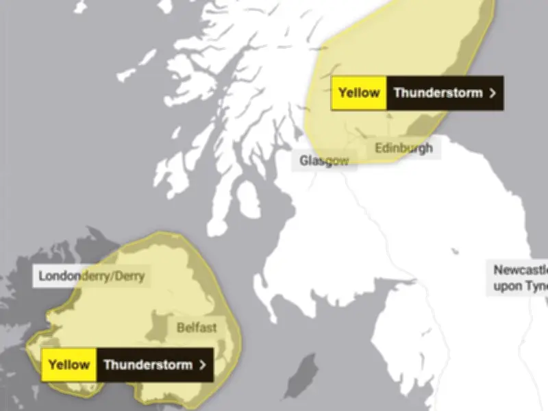
The Met Office has issued thunderstorm warnings for 22 areas across the UK, with heavy rain and potential disruption expected today and tomorrow.
Warnings in effect
Two yellow thunderstorm alerts have been issued for Tuesday, August 4, covering parts of Northern Ireland and eastern Scotland. These alerts are in force until 9pm and 10pm respectively. A further alert has been issued for parts of Scotland for Wednesday, August 5, from 10am to 9pm.
The warnings follow a period of hot weather, with temperatures reaching 33.5C in Wisley, Surrey, on Monday. This marked the 20th day of 2026 when temperatures of 32C or higher were recorded, exceeding the previous record of 19 days set in 1995, according to the Met Office.
Health alerts remain
The UK Health Security Agency (UKHSA) has issued amber heat health alerts for the East Midlands, East of England, South East and London, which are expected to remain in place until Wednesday morning. Yellow alerts have also been issued for the North West, South West, West Midlands, and Yorkshire and The Humber.
The Met Office warned that heavy showers and thunderstorms could cause 'some disruption to transport and outdoor events' in Northern Ireland. In eastern Scotland, similar disruption is possible into the evening.
Areas affected
The warnings cover 20 areas today, including counties in Northern Ireland and regions in Scotland. For Wednesday, six areas in Scotland are under alert, with the Met Office stating: 'Slow-moving heavy showers and thunderstorms may cause some disruption.'
While no thunderstorm warning has been issued for Greater Manchester and the north west, forecasters have indicated the region could see heavy rain.




