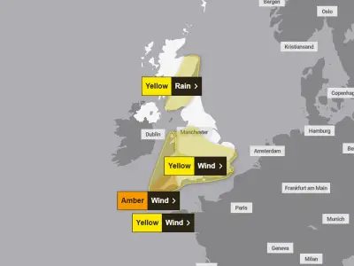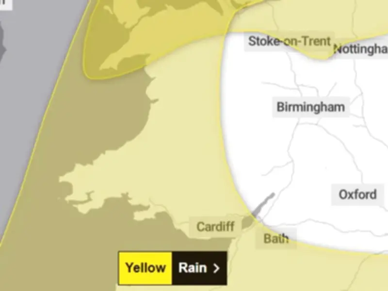
The Met Office has updated its severe weather warnings for Storm Boelo, issuing a 12-hour yellow weather warning covering the whole of Wales on Saturday. The new warning follows the expiry of an amber warning associated with Storm Austen, the first named storm of the season, as it moves away.
Warning details and affected areas
The warning is in place from 11am until 11pm on Saturday and affects Blaenau Gwent, Bridgend, Caerphilly, Cardiff, Carmarthenshire, Ceredigion, Conwy, Denbighshire and Flintshire. Gwynedd, Isle of Anglesey, Merthyr Tydfil, Monmouthshire, Neath Port Talbot, Newport, Pembrokeshire, Powys, Rhondda Cynon Taf, Swansea, Torfaen, Vale of Glamorgan and Wrexham are also included.
Gusts of 76mph were recorded at St Mary's airport in the Isles of Scilly in the early hours of Friday morning, with 74mph recorded in Aberporth.
Potential impacts and safety advice
The Met Office warns there is a chance that power cuts may occur, with the potential to affect other services, such as mobile phone coverage. It adds: "There is a small chance of injuries and danger to life from flying debris. Some damage to buildings and trees, such as tiles blown from roofs and large branches or trees blown over, could happen."
Travel disruption is also possible, with the Met Office noting: "There is a small chance of longer journey times or cancellations as road, rail, air and ferry services are affected. There is a small chance that some roads and bridges could close." Coastal areas face risks from large waves, with the Met Office stating: "There is a small chance that injuries and danger to life could occur from large waves and beach material being thrown onto sea fronts, coastal roads and properties."
Advising residents, the Met Office says: "Prepare to protect your property and people from injury. Check for loose items outside your home and plan how you could secure them. Items include: bins, garden furniture, trampolines, tents, sheds, and fences. People cope better with power cuts when they have prepared for them in advance. It's easy to do; consider gathering torches and batteries, a mobile phone power pack and other essential items."
For those travelling, it recommends: "Give yourself the best chance of avoiding delays by checking road conditions if driving, or bus and train timetables, amending your travel plans if necessary." Coastal safety is emphasised: "If you are on the coast, stay safe during stormy weather by being aware of large waves. Even from the shore large breaking waves can sweep you off your feet and out to sea. Take care if walking near cliffs; know your route and keep dogs on a lead. In an emergency, call 999 and ask for the coastguard."
Outlook for the weekend and beyond
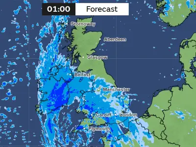
While heavy rain and the strongest winds will persist through Sunday in the north, further south across southern England and Wales conditions will be drier and brighter but still windy. Into the next week, unsettled conditions are forecast to persist, especially in the north, as another area of low pressure approaches the UK bringing further wet and windy conditions. Further ahead, forecasts suggest higher pressure moving in towards the end of the week, bringing more settled weather to the UK.