The Met Office has issued a yellow warning for ice covering parts of the North East for a 16-hour period, with icy stretches expected to lead to difficult driving conditions.
The alert affects County Durham and Northumberland and runs from 6pm on Sunday, November 15, to 10am on Monday, November 16. It comes as temperatures plunge across the UK, with some areas set to see snow, including many parts of Scotland.
Cold health alert already in place
The UK Health Security Agency has already sent out a yellow cold health alert for the region, running from 9pm on Sunday, November 15, until 9am on Thursday, November 19.
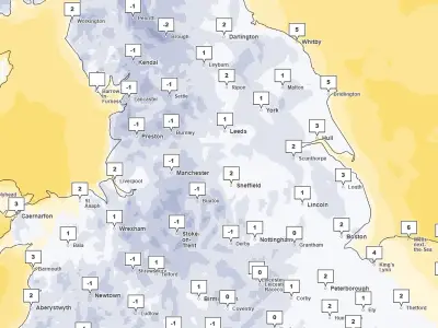
The Met Office says an area of rain and hill snow (snow mainly above 200m but not expected to be impactful) will clear to the southeast tonight, with skies then at least partially clearing. This will result in temperatures falling below freezing and some icy stretches developing on untreated surfaces.
Driving conditions and wintry showers
The weather specialists say these conditions will probably not develop across northern England and southeast Scotland until the end of the night. Across northern Scotland, icy conditions are likely to be exacerbated by some wintry showers, with snow falling to low levels for a time before becoming mainly confined to higher ground late in the night.
No more than 1-2 cm is likely at lower levels, with higher ground perhaps seeing up to 4 or 5cm from these wintry showers.
Due to the ice, people are being warned to expect "some injuries from slips and falls on icy surfaces" and icy patches on some untreated roads, pavements and cycle paths.
Advice for travellers
The Met Office advised: "Keep yourself and your family safe when it is icy. Plan to leave the house at least five minutes earlier than normal. Not needing to rush reduces your risk of accidents, slips, and falls."
"If you need to make a journey on foot, try to use pavements along main roads which are likely to be less slippery. Similarly, if cycling, try and stick to main roads which are more likely to have been treated. Give yourself the best chance of avoiding delays by checking road conditions if driving, or bus and train timetables, amending your travel plans if necessary."
The North East forecast for Sunday is for a dry start with local frost, with cloud thickening from the northwest through the morning, followed by outbreaks of rain spreading southeast, becoming heavy and persistent in places during the afternoon. Maximum temperature 8 °C.
Sunday night will be cloudy, wet and windy with outbreaks of rain, becoming cold with frost developing across western parts and over higher ground, with a minimum temperature of -4 °C. Monday will be cloudy with hill fog and outbreaks of rain at first, then dry with sunny spells from late morning, with a maximum temperature of 5 °C. The outlook from Tuesday to Thursday is cloudy and unsettled, with spells of rain and strong winds at times Tuesday and Wednesday, perhaps drier and brighter Thursday, remaining generally cold.