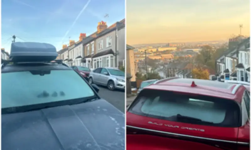
London woke to frosty conditions on Saturday as a cold snap drove temperatures down to -2C overnight in the capital. Forecasters had warned of a “very cold night” before a chilly start to the weekend.
Met Office chief forecaster Chris Bulmer said: “The UK forecast has moved to a colder phase with the daytime temperatures for most locations likely to stay in single figures.”
Coldest night of the season
Friday brought the first widespread frost of autumn after the UK experienced its coldest night of the season so far on Thursday. An overnight temperature of minus 6.6C was recorded in Sennybridge, near Brecon in south Wales, while Shap, a village near Penrith in Cumbria, recorded a low of minus 6.5C.
Met Office deputy chief forecaster Steven Keates said: “The outlook is changeable with spells of rain, sleet and some hill snow.
“On Sunday, low pressure will bring rain or showers to many areas.
“Precipitation will be most persistent across northern Scotland, where there is an increasing chance of snow developing later in the day.
“This will mainly fall over high ground, where accumulations are likely, but some snow could fall to lower levels too. Ice may also become a hazard.”
Cold health alert issued
The UK Health Security Agency (UKHSA) issued its first yellow cold health alert of the season this week, covering the North West and West Midlands. The warning came into effect at 9am on Thursday and is in place until noon on Saturday.
The agency said the colder weather can lead to the increased use of healthcare services and greater risk to life for vulnerable people.
Dr Anya Gopfert, consultant in public health at UKHSA, said: “This is the first cold-health alert of the winter, but we can expect more as we move further into the season.”
Winter hazards ahead
The Met Office has warned there is an increased chance of “winter hazards” in its long-range forecast, which suggests southern Britain is set to face some of the worst weather. The forecaster says there are indications that a “blocked weather pattern” will develop in the early part of December, increasing the chances of colder conditions overall.
“Further rain is probable across southern and perhaps central areas,” it predicts in its forecast for the two weeks from November 28 to December 12. “With a blocked weather pattern signalled to develop, this increases the chance of colder conditions overall, with associated winter hazards, e.g. snow and ice, occurring,” the Met Office adds.
The outlook for the rest of November is also looking distinctly changeable and unsettled. Southern areas of the country are most likely to experience the wettest weather as low pressure systems roll in from the Atlantic, with “strong winds” also possible.
It comes as the polar vortex above the Arctic reversed direction in what scientists say is the earliest major “sudden stratospheric warming” (SSW) on record. The normal westerly flow of the polar vortex keeps cold air locked above the North Pole, but a weakening of the polar vortex in recent weeks has seen the formation of an easterly wind pattern.
SSWs typically occur in winter and are linked with sharp cold spells over the UK, such as the infamous “Beast from the East” in late February and early March 2018. The impact of a major SSW in autumn on Britain’s weather is unclear, and it comes as meteorologists and governments around the world fear the impact of a record-breaking El Nino in the Pacific, which scientists say is likely to cause extreme weather such as floods, typhoons and droughts that risk the lives of millions around the planet.