The first cold spell of autumn is set to hit the North East, with temperatures expected to plummet below zero across large areas of Northumberland, Tyneside and County Durham by mid-November.
A weather map shows that 41 areas across the UK are now at risk of freezing temperatures, according to The Mirror. The Met Office has already said “colder conditions” are on the cards towards the end of next week, with the national weather agency also suggesting “wintry showers” are possible.
Temperature plunge from November 11
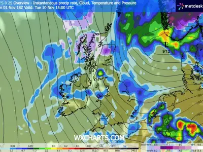
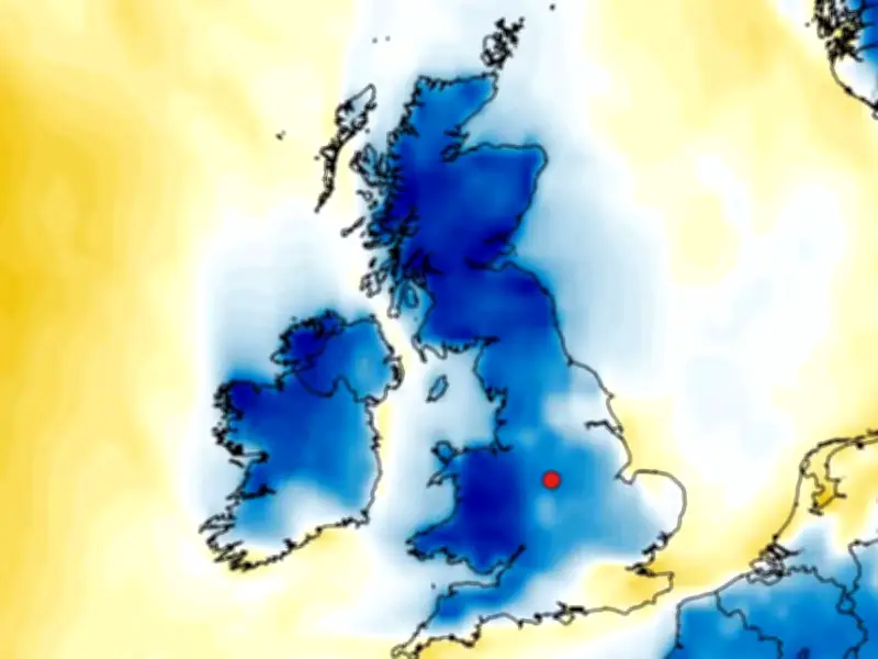
GFS weather model readings suggest temperatures will start to plummet from November 11, initially in Scotland before the freeze spreads to England and Wales. The mercury could plunge as low as -3C in Scotland at around 6pm while large parts of the north see sub-zero temperatures.
And the cold spell could now continue through to November 16, with temperature anomaly maps remaining blue, indicating that temperatures could drop well below the seasonal average. A WXCharts map for Saturday, November 14, shows temperatures again down to -3C at midday in Scotland while it will also be freezing in parts of northern England and much of Wales.
Widespread freeze and polar vortex disruption
Then two days later on November 16, the freeze will be even more widespread, stretching down to Derbyshire in England. Forecasters believe disruption to the polar vortex is from El Nino. The polar vortex is a swirling mass of very cold air which sits above the Earth's poles. It weakens, allowing icy Arctic air to sweep southwards, with sudden stratospheric warming where winds change direction or just slow down.
These changes are notorious for triggering icy weather and snowfall - although maps do not suggest we will see flurries over the coming weeks. Experts had thought that the polar vortex could collapse in January next year, but it now appears to be coming earlier than predicted.
Met Office forecast for November 11-20
The Met Office has issued a forecast covering November 11-20 which predicts the wintry showers as well as changeable weather with Atlantic fronts bringing rain and strong winds.
It states: "At the start of this period, outbreaks of rain across the south of the UK will clear away as clearer conditions spread from the north. A few wintry showers are likely in the far north, but otherwise this will mean a spell of fine and dry weather developing for most areas."
"Over the following weekend a change to more changeable weather is likely, with Atlantic frontal systems bringing rain and some strong winds. Unsettled or changeable weather will likely continue through the following week. After a cold start, temperatures will probably be above average overall."
Areas with freezing temperatures in mid-November include Northumberland, Durham, Tyne and Wear, Greater Manchester, Cheshire, Derbyshire, Cumbria, Lancashire, Herefordshire and Yorkshire.