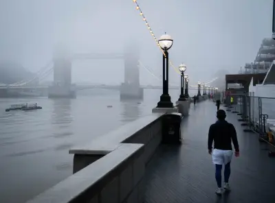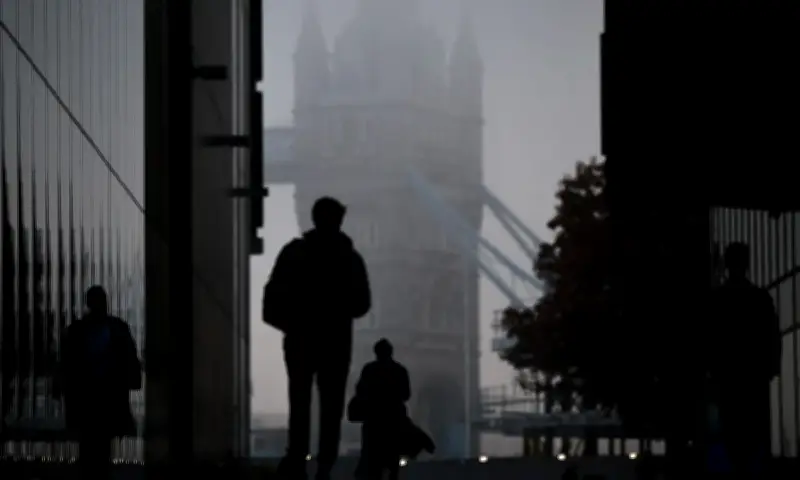
Mayor Sadiq Khan has triggered a high air pollution alert for Tuesday in London, following advice from forecasters at Imperial College London, as dense fog and light winds allowed harmful particles to build up across the capital. Vulnerable residents are particularly urged to take care.
The alert comes as the Met Office issues a separate yellow fog warning for large parts of England and Wales, with visibility expected to fall below 100 metres in some areas overnight.
Pollution build-up and causes
Forecasters say dense fog and very light winds allowed pollution to accumulate over the weekend and linger into Monday morning, with smoke from Bonfire Night and Diwali fireworks, as well as wood burning, likely to have contributed. It is the fourth high air pollution alert issued in London this year.
The Mayor is encouraging Londoners to help reduce pollution by walking, cycling or using public transport where possible, avoiding unnecessary car journeys and refraining from burning wood or garden waste. Information has also been shared with GPs and emergency departments across the capital to help them support vulnerable patients.
Warnings and travel impact
Warnings will be displayed across London's transport network, including Underground services and bus stop countdown signs, while schools and London boroughs will also be notified.
The Met Office has issued a yellow weather warning from 6pm on Monday until 10am on Tuesday, as forecasters predict another night of thick fog stretching from Luton to Manchester. Drivers face difficult conditions and longer journey times, while public transport delays and flight cancellations are also possible.
The warning covers parts of central and northern England, North Wales and East Anglia, with fog expected to develop on Monday evening before becoming particularly dense overnight.
Official responses and outlook
The Deputy Mayor for Environment and Energy, Mete Coban, said: “Toxic air is responsible for thousands of premature deaths in London each year, which is why the Mayor has done everything in his power to tackle it, which includes launching the world’s largest clean air zone. It is really important we all do our bit to protect those who are most vulnerable as we continue working to build a safer and greener London for all.”
Conditions should begin to improve on Tuesday morning as the fog gradually clears, but the respite could be short-lived, with colder, frosty weather on the way later in the week.
Met Office chief meteorologist Jason Kelly said persistent high pressure, light winds and clear skies had created ideal conditions for fog to form, while weak November sunshine had made it slow to lift. “We’re expecting one more night of dense fog, with a warning in place for some areas. Increasing cloud and wind should then limit further widespread fog from developing,” he said.
Met Office meteorologist Aidan McGivern warned that already poor visibility on Monday would worsen overnight, with some areas facing visibility of less than 100 metres. Freezing fog patches are also possible across central and southern Scotland, while temperatures across the northern half of the UK are expected to fall into the low single figures. In some sheltered areas with clear skies, temperatures could plunge to between minus 3C and minus 5C.
A cold front bringing rain to the far north of Scotland will introduce colder air across much of the UK as the week progresses.
Mr McGivern said in the daily video forecast the poor visibility during Monday is “thickening overnight”. He added: “It’s a cold night in the northern half of the UK, with temperatures widely in the low single figures, and in some sheltered spots where we get the clear skies, minus three to minus five celsius. Outbreaks of rain, meanwhile, turn up in the far north of Scotland. This is a cold front, which will introduce colder air through the week across many parts of the UK. But in the meantime, this weather front, an occluded system, is moving into the South and South West, and that’s going to lead to a wet start to the day (Tuesday) for the south-west of England, and that rain eventually pushing into the South and central part of Wales, other southern coastal counties of England.”