Rain is forecast to hit Greater Manchester later this week, marking an end to the prolonged dry spell of weather.
It comes as several parts of the UK have been hit with water restrictions due to the exceptional period of no rain. Thames Water on Tuesday became the latest firm to announce a hosepipe ban across southern England.
Bans are also in place for Southern Water customers in Hampshire and the Isle of Wight, Cambridge Water customers, Affinity Water customers in Bedfordshire, Berkshire, Buckinghamshire, Essex, Hertfordshire, Surrey and parts of London, and Anglian Water customers in the East of England.

Reservoir and river levels
The Environment Agency said six reservoirs are currently classed as having “notably low” levels, including Wimbleball in Somerset, Grafham in Cambridgeshire and Hanningfield in Essex, while Blagdon reservoir in Somerset is classed as being “exceptionally low”.
Only 13% of rivers are classed at normal levels for this time of year, with the Rivers Avon (Hampshire), Cam, Derwent (Yorkshire), Swale, Tone, Wye and Yare currently seeing exceptionally low levels.
Official statement
Helen Wakeham, chair of the National Drought Group and director of water at the Environment Agency, said: “All sectors are taking action, and we are grateful to the public for following the restrictions, where in place, to make sure there is enough water for everyone this summer.
“We want everyone to stay safe and hydrated during the hot weather but every drop we can save is a drop more for nature and agriculture.”
Rain forecast for Greater Manchester
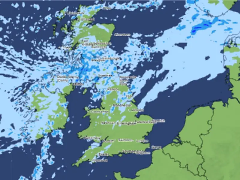
After almost no rain for the past few weeks, the Met Office weather maps now show some precipitation is set to hit Greater Manchester this weekend, as well as in Scotland and other northern parts of the country.
Rain is on the forecast in Manchester from around 7pm on Saturday (July 25) and is set to continue until around 1pm the following day.
The long-range forecast - which covers the period between July 25 and August 4 - has suggested that the weather is likely to be 'changeable' for the rest of July, with a mixture of rain and sunshine.
"This period looks like being largely changeable," the Met Office says, "with many parts likely to see some rain at times. Rain will spread southeast across most if not all parts of the UK through this weekend, with some showers following."
"Further bands of rain look likely to spread southeast next week, interspersed with sunny spells and some showers."
Possible return of high pressure
High pressure - which generally brings warm and sunny conditions - could also return in August, the Met Office says, with the potential for 'very warm' weather again at the beginning of August.
The forecast reads: "Confidence becomes lower as we approach the turn of the month, but there are hints that high pressure could return for a time, which would mean dry conditions resuming, especially in the south."
"Winds will be mostly light or moderate, but occasionally fresh or strong around some coasts, mainly in the north. Temperatures will be near or above normal, warmest in the south, and perhaps becoming very warm again by the start of August."