A strong cold front from the northern Pacific brought unseasonal snow to parts of the north-west US over the weekend, while the eastern US braces for a heatwave that could push temperatures to 40C in major cities.
Western Snow at Unusually Low Elevations
The cold front dropped temperatures 5-10C below normal from the Canadian border to California, with some northern areas more than 10C below average. This pattern is expected to persist for much of the coming week.
In the Rocky Mountains of Idaho, Montana, and Wyoming, the front brought the first significant rainfall in weeks. Combined with cold air, this produced snowfall at elevations as low as 1,800 metres on Sunday, well below the typical summer snow line of about 3,300 metres. Several inches of snow are expected at higher altitudes through Monday.

Wildfire Danger Intensifies
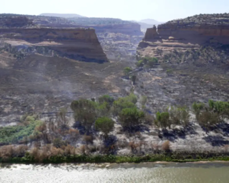
Paradoxically, the cold front has increased wildfire risk across the drought-stricken western US. Lightning strikes from the front's leading edge ignite dry vegetation, while strong winds fan existing fires.
The gustiest conditions over the weekend hit Utah, Colorado, and Arizona, where several major fires were already burning. Winds are forecast to shift north into Wyoming on Monday. The 2026 fire season is shaping up to be one of the worst on record in terms of number and extent of areas affected, according to analysts.
Eastern Heatwave Ahead
While the north-west cools, the north-east US is set for a dramatic temperature swing. A heatwave developing ahead of the Fourth of July weekend will push highs into the high 30s Celsius for parts of the Midwest and Northeast.
Forecast models indicate that New York, Philadelphia, and Washington DC could reach 40C (104F) on Thursday and Friday, with overnight lows struggling to drop below the high 20s Celsius. For context, the average July high in New York is 29C, and in Washington it is 32C. The record high temperatures stand at 42C for New York and 41C for Philadelphia and Washington.