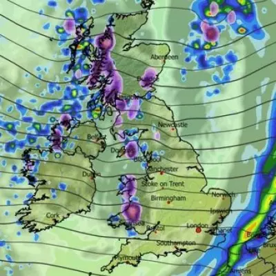
Britain is bracing for a severe battering as Storm Benjamin sweeps across the country, bringing destructive winds reaching 70mph and torrential downpours that have triggered multiple flood alerts.
The Met Office has escalated warnings to amber for parts of Wales and southwest England, indicating potential danger to life and property as the storm intensifies throughout Wednesday.
Travel Chaos and Widespread Disruption
Transport networks are facing significant disruption with road closures and train services severely affected. Commuters are being urged to check their journeys before travelling as conditions rapidly deteriorate.
Key impacts include:
- Multiple flood warnings across river catchments
- Coastal areas at risk from large waves and spray
- Potential power outages in affected regions
- Dangerous driving conditions on exposed routes
Regional Breakdown: Where Will Be Hardest Hit?
Northern Ireland and western Scotland felt the storm's initial fury overnight, with heavy rain persisting into Wednesday morning. The severe weather is now tracking eastwards, set to affect the majority of the UK throughout the day.
Meteorologists warn that the combination of saturated ground from previous rainfall and new deluges creates perfect conditions for flash flooding, particularly in already vulnerable areas.
Emergency Services on High Alert
Emergency services across affected regions have implemented severe weather protocols, with additional resources on standby. Residents in flood-prone areas are being advised to prepare emergency kits and monitor official updates.
The Environment Agency has deployed temporary flood barriers in several at-risk locations as a precautionary measure against rising water levels.
With weather models predicting the storm system will continue to intensify before moving offshore Thursday, authorities are warning the public to remain vigilant and avoid unnecessary travel during the worst of the conditions.


