
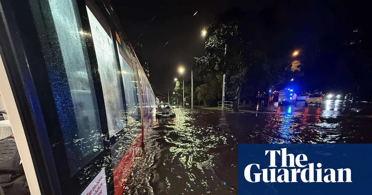
Two tornadoes, record-breaking rain and large hail have struck New South Wales in the 24 hours to Thursday morning, as supercell thunderstorms and a band of rain sweep the state. The State Emergency Service (SES) responded to more than 850 calls for assistance in a 50-minute period around 8.30pm on Wednesday, with crews attending about 600 incidents.
A number of vehicles were caught in flash flooding, including a light rail vehicle stranded on Anzac Parade in Randwick. SES crews brought 20 to 30 passengers to safety, using an Ark Angel raft to ferry an elderly passenger across floodwaters. They also assisted about 10 passengers from a bus that came into trouble in the heavy rain.
At least two tornadoes touched down on Wednesday afternoon—one near Young in the state's south-west, and one near Caragabal, about 400km west of Sydney. Tornadoes are fairly unusual and particularly rare in NSW, said Angus Hines, a senior meteorologist at the Bureau of Meteorology (BoM). They form from supercell thunderstorms, where a column of rising air spirals northwards and creates a vortex that can touch the ground under the right conditions.
Several Sydney suburbs recorded their highest September rainfall in the 24 hours to Thursday morning. Observatory Hill weather station recorded 122mm of rain, the city's second highest September rainfall on record. The highest fall was 181mm at Greenwell Point, 93km south of Wollongong. Multiple severe weather warnings remained in place on Thursday, including for damaging winds and hazardous surf across NSW.
The SES continued to monitor for minor flooding along several rivers, which could lead to local road closures. A group of hikers were rescued at Wattamolla, south of Sydney, after heavy rainfall. Wind speeds of 100km/h were recorded at the coastal picnic area on Thursday morning. Conditions were expected to ease, but damaging wind gusts of up to 90km/h were forecast to last into the afternoon due to a complex low pressure system.
Large and powerful south to south-east waves are forecast to batter the northern and central coasts through to early Friday, bringing hazardous surf and increased risk of coastal erosion. NSW police marine area command advised people to consider staying out of the water and avoid walking near surf-exposed areas.




