
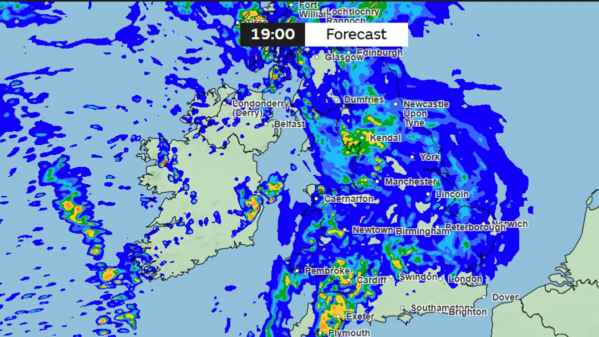
The Met Office has warned that 34 counties across England are set to be hit by heavy rain for up to 30 hours, bringing an abrupt end to the recent heatwave. The downpours are expected to begin on Monday at 1pm, sweeping across Wales and parts of northwest England before spreading to most of the country, and are forecast to clear by around 7pm on Tuesday.
Weather maps show yellow markers indicating heavy rainfall of 4-8mm per hour, with orange markers indicating even heavier falls of 8-16mm per hour. The warning comes just days after the UK recorded its hottest ever May day, with temperatures reaching 35.1°C in Kew Gardens, London.
The Met Office's long-range forecast suggests that the meteorological summer will start on an unsettled note, with spells of rain on Monday possibly followed by heavy and thundery showers on Tuesday. Chief Forecaster Chris Bulmer said: "We're now starting to see this spell of very hot weather break down."
He added that while parts of the southeast could still reach 32°C on Thursday, many areas will feel fresher conditions moving in through Friday and into the weekend as a weak cold front moves southeast. Temperatures are expected to return closer to average for the time of year, with accompanying rainfall for many through the weekend and into next week.




