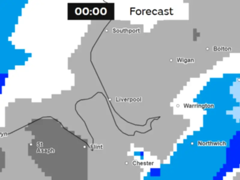
The Met Office has indicated that snow could fall in Merseyside at around 9pm on Monday night, with wintry showers expected to continue into the early hours of Tuesday morning, November 17. The weather maps show the snow moving away from the region at around 3am.
The forecast comes as the UK experiences its first cold snap of the winter, with some areas of the country expected to see snow. The UK Health Security Agency (UKHSA) has issued a yellow cold-health alert for the North West and West Midlands regions, running from 9am on Thursday, November 12 until 12pm on Saturday, November 14. Other regions of England are currently unaffected.
Cold-health alerts in place
Yellow cold-health alerts may be issued during periods of cold which would be unlikely to impact most people, but could impact those who are particularly vulnerable. Health officials warn that low temperatures can result in increased use of health care services by vulnerable people and an increased risk to health for individuals aged 65 years and over.
Met Office spokesperson Stephen Dixon said: "The UK is heading towards what will feel like the first cold spell in late autumn, with temperatures likely to drop down towards minus 6C overnight for some in the coming days and a fairly harsh frost likely for some."
He added: "Through the day-to-day, the main weather of note I suppose is the possibility of some snow over higher ground in northern Scotland. This isn't massively unusual for this time of year but could see a couple of centimetres accumulating over the very highest ground in the north of Scotland."
Why snow forecasts are tricky
The Met Office said that forecasting snow is particularly difficult because the difference between rain, sleet and snow can come down to very small changes in atmospheric conditions. A slight difference in temperature or wind direction can alter the precipitation type.
The intensity of precipitation matters too. Heavier precipitation can cool the air close to the surface, sometimes allowing snow to reach the ground, while lighter snow can melt on its journey through warmer air and arrive as rain or sleet.
What the rest of the month looks like
This means that while forecasts may identify the potential for a colder spell well in advance, confidence about exactly where, when and how much snow will fall generally becomes much higher only within a few days of an event.
In the Met Office's long-range forecast looking ahead to the end of the month in the UK, it said: "A gradual transition to more changeable conditions is expected at the start of the period. This will allow areas of low pressure to move in from the Atlantic and bring occasional bands of rain and periods of windy weather."
"Whereas northern areas are likely to remain in the colder, but generally drier and brighter conditions, for a little longer. Overall, this period is likely to be wetter than average for the majority of the country."
"And whilst colder conditions will be possible at times, it will often be mild, with temperatures near or a little above average for the time of year."