Snow is forecast to sweep across 47 counties of the UK on Monday and Tuesday, with the first flakes expected to land on Monday morning (November 16) around 9am, according to meteorologists. Freezing temperatures are already affecting the country, and the wintry weather is set to continue into early next week, with intermittent flurries extending to Tuesday (November 17) afternoon.
Where Snow Will Fall
The Met Office has indicated that northern Scotland has the greatest chance of seeing snow on Monday. Its forecast for Monday, issued early on Friday, said: "Unsettled with spells of rain or showers Sunday and Monday. Rain in the south on Tuesday, with some hill snow possible. Brighter with showers elsewhere. Often windy and feeling cold."
On Thursday, Met Office scientists also said: "Northern Scotland has the greatest chance of seeing snow, with wintry showers affecting northern and eastern Scotland and the Northern Isles. Snow is most likely above a few hundred metres, although temporary accumulations could occur as low as 200-300 metres. Around 2-5 cm could accumulate above 400 metres. Across the far north and northeast, showers will be frequent and blustery at times."
Counties Forecast for Snow
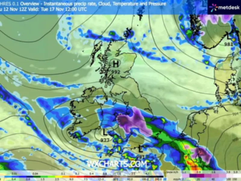
WX Charts has forecast that 47 UK counties could see snowfall: seven in Scotland, 14 in Wales, and 26 in England. The affected areas are mostly rural, including northern Scotland, mid-Wales, and most of England from north to south. Counties as far north as Cumbria and as far south as Buckinghamshire are forecast to see some snow across both days. Monday is expected to bring more flurries, while Tuesday could see more intense snowfall.
The 47 counties expected to see snow on Monday and Tuesday are as follows.
Scotland
- Aberdeenshire
- Argyll and Bute
- Dumfries and Galloway
- Highland
- Perth and Kinross
- Scottish Borders
- Stirling
Wales
- Blaenau Gwent
- Caerphilly
- Carmarthenshire
- Ceredigion
- Conwy
- Denbighshire
- Flintshire
- Gwynedd
- Merthyr Tydfil
- Monmouthshire
- Neath Port Talbot
- Powys
- Rhondda Cynon Taf
- Wrexham
England
- Bedfordshire
- Buckinghamshire
- Cambridgeshire
- Cheshire
- Cumbria
- Derbyshire
- East Riding of Yorkshire
- Gloucestershire
- Greater Manchester
- Herefordshire
- Lancashire
- Leicestershire
- Lincolnshire
- Merseyside
- Northamptonshire
- North Yorkshire
- Nottinghamshire
- Oxfordshire
- Rutland
- Shropshire
- South Yorkshire
- Staffordshire
- Warwickshire
- West Midlands
- West Yorkshire
- Worcestershire
Snow is at its most intense on Tuesday at 9am, according to WX Charts, with more widespread snow expected on Monday at 12 noon. The adverse weather is set to continue into early next week, with the Met Office warning of windy and cold conditions.