
Tropical Cyclone Narelle is on a collision course with Western Australia, with the Bureau of Meteorology predicting it will strike the coast as a severe category 3 system on Friday night. The storm, which has already impacted far north Queensland and the Northern Territory, is now tracking across the Indian Ocean toward Perth, posing significant threats to remote towns and coastal areas.
Path and Intensity Forecast
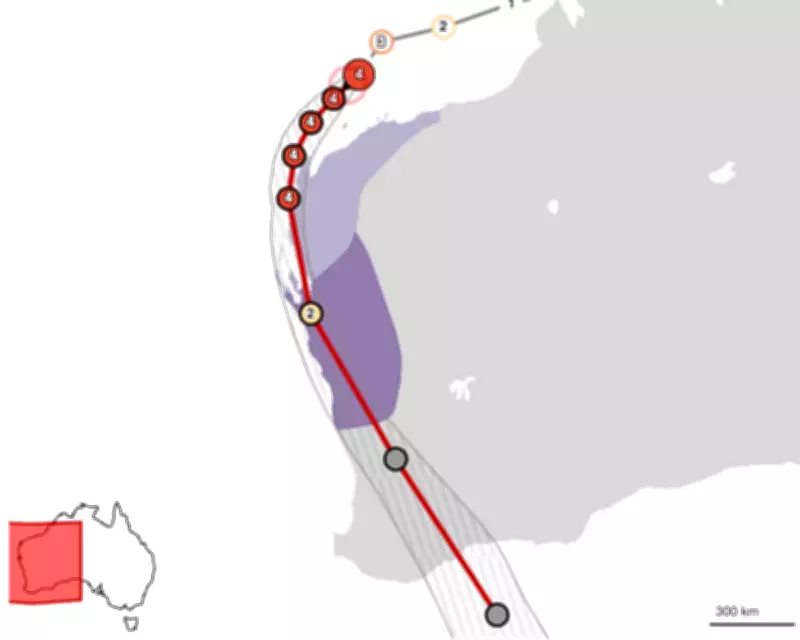
The tracking map for Cyclone Narelle indicates its expected path over Western Australia, with landfall anticipated near the tourism town of Denham in Shark Bay. As of Thursday, the system was regaining strength, with wind gusts potentially reaching up to 275 km/h in Exmouth. By the time it approaches Perth, Cyclone Narelle will have traveled more than 5,500 kilometers, making it the first storm in two decades to make landfall in three Australian states and territories.
Impacts and Warnings
Residents in Western Australia are urged to prepare for severe weather conditions, including destructive winds, heavy rainfall, and potential flooding. The Bureau of Meteorology has issued warnings for coastal communities, with updates available through live forecast track maps. This event highlights the increasing frequency of extreme weather patterns in the region, necessitating heightened vigilance and emergency preparedness.

As the story develops, further updates will be provided on the storm's progression and its effects on local infrastructure and safety. Authorities are monitoring the situation closely to mitigate risks and ensure public safety during this hazardous weather event.


