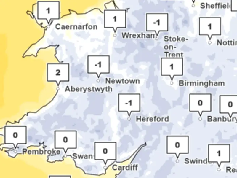
Met Office weather maps show temperatures in Wales will drop below freezing tonight as a blast of Arctic air hits the UK, causing temperatures to plummet. An area of low pressure to the east of the UK is dragging a cold northerly wind across the country, bringing winter conditions.
Overnight Temperatures to Plummet
According to Met Office weather maps, average overnight temperatures in Wales have been around 6C to 8C this week, but these figures will plummet tonight. These temperatures are below average for the time of year, the weather agency said.
The Met Office forecast for Friday says: "Friday will begin cold and frosty for many. Away from showers in the far north and northwest, there should be plenty of sunshine, with daytime temperatures generally around 6C to 8C. The northerly airflow will gradually ease, but cold air will remain in place."
Cold Snap Details by Time
Forecasters have also given their verdict on whether the UK will see its first snowfall of the winter season, with the highest chance of snow flurries forecast for Scotland.
At 9pm on Thursday, it will get very chilly after the sun sets. By 2am on Friday, temperatures overnight will continue to drop, with lows of 1C expected widely and some areas dipping below freezing. At 6am on Friday, temperatures around 0C are expected across the country. The maximum temperatures on Friday will be below average for the time of year.
The Met Office says the frosty starts are expected to continue into Saturday morning.
Weekend Snow Risk
Addressing the snow risk this weekend, the weather agency added: "The weather becomes more complicated through the weekend as areas of low pressure and associated fronts interact with the cold air already across the UK."
"Much of the Midlands, eastern and south-eastern England should start Saturday dry, sunny and frosty. However, rain will become increasingly widespread across northern and central Scotland, with further showers affecting northern England and north Wales."
The main snow risk arrives across northern Scotland on Saturday night into Sunday as rain meets colder air. Some snow could temporarily reach lower levels, but the most significant accumulations are expected over higher ground. Around 2 cm is possible above 200 metres, with several centimetres over higher routes and potentially 5-10 cm over the tops of the hills.
Sunday will remain mixed. Snow across northern Scotland should gradually ease, with rain at lower levels, while cloud and patchy rain or showers spread into western areas and Northern Ireland. England and Wales should remain largely dry, although increasingly cloudy.
By Monday, the weather pattern will change as Atlantic weather returns to dominate. This will bring more unsettled weather, but temperatures will rise again, with fewer frosty nights expected.