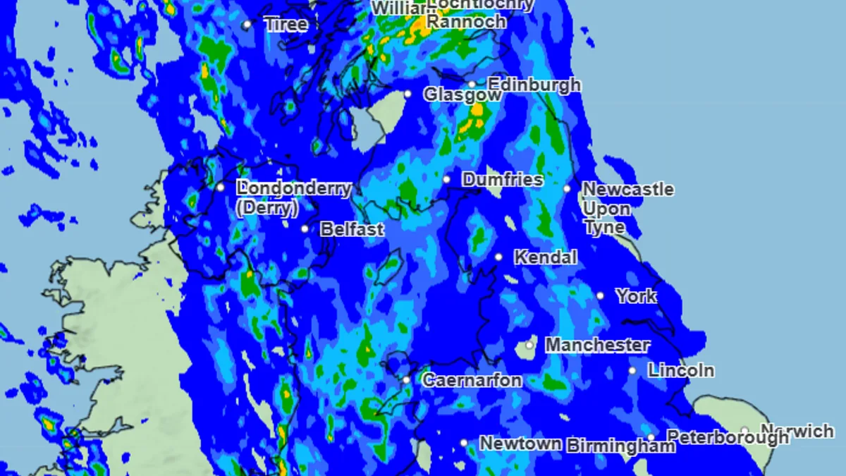
Met Office Issues Urgent UK-Wide Weather Alerts for Rain, Wind and Snow
UK-Wide Weather Alerts: Rain, Wind, Snow Warnings

The Met Office has issued a comprehensive series of weather warnings covering the entire United Kingdom, urging residents to prepare in advance for potentially hazardous conditions. A complex weather system, named Storm Chandra, is bringing a dangerous mix of heavy rain, strong winds, and significant snowfall to various regions.

Nationwide Warnings and Immediate Risks

Amber-level warnings, indicating a medium likelihood of high impacts, are in effect for wind in coastal parts of Northern Ireland and for rain in England. The Met Office has explicitly warned that these conditions could lead to injuries or danger to life from flying debris, large waves, and beach material being thrown onto coastal areas. Every inch of Northern Ireland is under a rain and wind warning, with the amber wind alert stretching from Ballycastle down to Kilkeel.

Storm Chandra's Path and Hazards

Met Office Chief Forecaster, Paul Gundersen, detailed the risks: "Storm Chandra will bring a range of hazards to the UK through Monday night and Tuesday. Initially strong winds will impact the Isles of Scilly, western Cornwall and southwest Wales which are still vulnerable after Storm Goretti, gusts of 70 to 80mph are possible here." He further explained that heavy rain falling on already saturated ground in Dorset and southern parts of Devon, Somerset, and Cornwall presents an additional flooding hazard.

As the storm interacts with colder air further north, snow becomes a prominent threat. Forecasters warn that 10-20cm of snow could accumulate over higher ground in the Pennines, southern Scotland, and the Highlands.

What the Public Can Expect

The Met Office has outlined a series of potential impacts that residents across the UK should anticipate:

  • Homes and businesses could be flooded, causing damage to some buildings.
  • Significant travel disruption, including delays or cancellations to train and bus services.
  • Difficult driving conditions due to spray and flooding, with some road closures likely.
  • Some communities may become cut off by flooded roads.
  • Possible power cuts and loss of other essential services to homes and businesses.
  • Landslides are possible in prone locations.

Urgent Call for Preparedness

The national weather service is strongly advising the public to take preparatory steps. "People cope better with power cuts when they have prepared for them in advance. It’s easy to do; consider gathering torches and batteries, a mobile phone power pack and other essential items," the Met Office stated. This advice comes as the UK faces a day potentially filled with widespread weather-related issues.

Regional Breakdown of Active Warnings

As of the morning of Tuesday, January 27, the following weather warnings are in effect across the nations of the UK:

England

  1. Amber rain warning (from 5pm Monday to 9am Tuesday).
  2. Yellow rain warning (from 1pm Monday to 10am Tuesday).
  3. Yellow rain and snow warning (from 12am to 5pm Tuesday).
  4. Yellow wind warning (from 5am to 4pm Tuesday).

Scotland

Yellow rain and snow warning (from 5am to 11.59pm Tuesday).

Wales

While most Welsh warnings lifted this morning, one remains:

  • Yellow wind warning (from 5am to 4pm Tuesday).

Northern Ireland

  1. Yellow rain and wind warning (from 12am to 11.59pm Tuesday).
  2. Amber wind warning (from 5am to 9pm Tuesday).

Forecasters emphasise the importance of staying up to date with the latest forecasts and warnings for your local area due to the complex and evolving nature of this weather event.