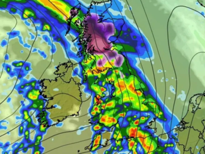
Weather maps produced by WXCharts forecasters show a 608-mile wall of snow and rain set to sweep across the UK amid a cold snap, with temperatures potentially dropping to -7C in some areas.
The country is braced for turbulent conditions following a sharp drop in temperatures, prompting the UK Health Security Agency (UKHSA) to issue its first cold-health alert of the winter. Temperatures could plunge to as low as -7C overnight in places, contrasting with the 14C recorded on Tuesday in Camborne, Cornwall.
Snow and rain to hit from November 17
Weather maps indicate that locations from Fort William in Scotland down to Cornwall in England are expected to face icy conditions from Tuesday, November 17. Snow is anticipated across parts of northern and western Scotland, including Fort William, Glasgow and Inverness, while torrential rainfall is likely to affect the rest of the UK.
Temperatures are projected to plummet to -7C near Fort William, with other parts of Scotland, including Glasgow, Inverness and Edinburgh, expected to see temperatures between -3C and -5C, according to the maps.
Cold-health alert issued
The UKHSA has issued a yellow cold-health alert for the Northwest of England and West Midlands from 9am on Thursday to midday on Saturday. The agency cautioned that low temperatures can place increased pressure on health and care services and urged people to check on loved ones and neighbours.
Temperatures are projected to drop significantly below the seasonal average by Thursday and Friday, bringing widespread frost to many regions. In some sheltered rural spots particularly vulnerable to cold weather, the mercury could fall to -6C or -7C. Overnight frost is anticipated across numerous areas, especially in rural parts of Britain, though these colder spells are predicted to become mostly confined to southern regions as the weekend unfolds.
Changeable conditions ahead
The Met Office's long-range forecast for November 16 to 25 states: "Following the tail end of the colder, more settled conditions seen over the weekend, a marked transition to more changeable conditions is expected at the start of the period."
"This will allow areas of low pressure to move in from the Atlantic and bring bands of rain and periods of windy weather. There will be some brighter, showery spells in-between however, particularly in the north," the forecast adds. "Overall, this period is likely to be wetter than average for the majority of the country. And whilst colder conditions will be possible at times, it will often be mild, with temperatures near or a little above average for the time of year."