Weather forecasting models show Brits face a cold spell, with afternoon temperatures dropping as low as 1C in some regions - and below 10C in every part of the country.
Temperatures look set to plunge from September 11, with the GFS weather model showing highs of just 11-12C around southern and eastern coasts at around midday, with 9C coming in the Midlands and Northern Ireland, and lows of 2C on the cards in parts of Scotland.
Temperature drop across the UK
By 6pm on September 11, the data shows highs of just 15C in the south-east - well below what is expected for this time of year - with afternoon temperatures remaining below 10C in Wales, northern England, Northern Ireland and Scotland.

Further cool conditions should follow on September 12, with temperatures dropping to just 1C in parts of northern England and Scotland. Every single county could see temperatures below 10C at midday, the data suggests.
The maps show temperatures peaking at just 13C in the south-east at around 6pm on September 12, with the Midlands reaching 11C, 12C in Northern Ireland and 10C in Scotland.
Cool conditions continue
Similar conditions are expected on September 13 too, with the GFS model once again showing single-digit temperatures across the country at midday - with London at just 7C. Afternoon highs may reach just 14C, with the warmest conditions expected in Northern Ireland and the south-west.
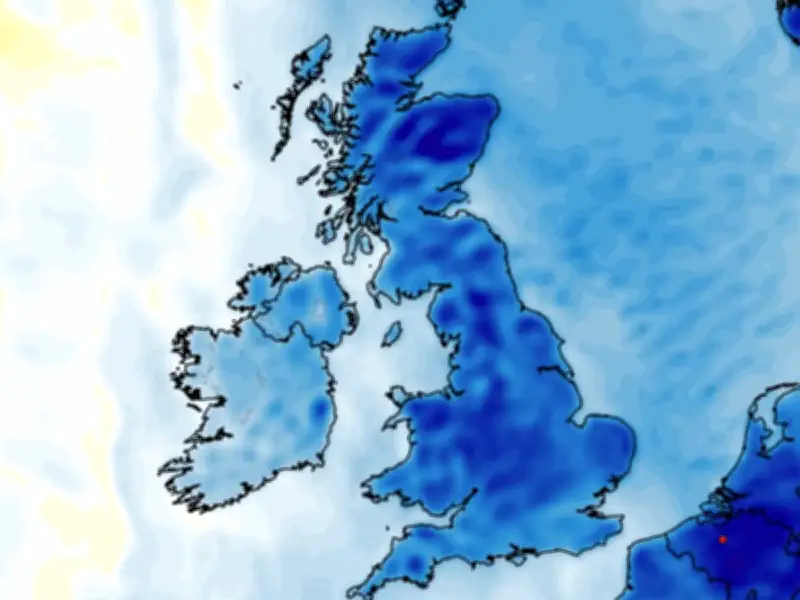
Temperature anomaly maps for this period show the UK shaded in areas of dark blue. This indicates that temperatures are expected to drop well below the seasonal average.
Met Office and BBC forecasts
The Met Office anticipates "unsettled" conditions for the first half of September, with rain in northern and western regions and drier spells in the south and east.
The Met Office forecast for September 5 to 14 states: "An unsettled period is likely, with many places seeing showers or longer spells of rain at times. Rain is expected to be most frequent across northern and western areas, while the south and east are more likely to see longer, drier spells. There is also the potential for some strong and gusty winds, particularly in the northwest."
The BBC forecast for September 7 to 13 says conditions should soon turn "cooler", with "wet and windy or showery weather" on the cards.
It states: "Atlantic weather systems should continue to dominate conditions into the second week of September, with low pressure and frontal systems tracking near or across the UK, so further periods of wet and windy or showery weather look most likely.
"Short-lived drier and sunnier spells should occur in-between, especially in the southern and eastern UK where conditions may be less wet overall than the north and west."