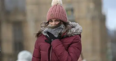
Snow is expected over high ground in Scotland this week as temperatures drop below freezing, and weather models now suggest some flurries could reach England and Wales next week.
Snow Forecast for the Week
The Met Office has said wintry showers, including hail, sleet and snow, are possible throughout this week over higher ground in Scotland. Its weather maps show significant snow falling over northern Scotland on Sunday morning, and its forecast adds that “hill snow” is possible from Sunday through to Monday.
Temperatures have also plunged below freezing this week. The Met Office says the mercury could drop as low as -8C in rural areas tonight, with daytime temperatures tomorrow expected to reach just 8C in London, Southampton, Plymouth and Belfast, 7C in Cardiff, Birmingham and Norwich, and 6C further north.
Models Show Snow Next Week
The GFS weather model suggests more snow and cold is on the cards from Tuesday. It shows snow arriving in Ireland, North Wales and northern parts of England at around 3pm on Tuesday, with the most intense flurries over higher ground in Snowdonia and the Yorkshire Dales.
By 9pm on Tuesday, the data suggests some light flurries will persist in eastern and north-eastern England, with heavier snow once again falling in northern parts of Scotland. The maps show snow persisting in Scotland until at least 6am on Wednesday, with some reaching southern parts of the country too.
Accumulation and Affected Counties
Potential snow accumulation charts from the GFS model show as much as 8cm (3.1 inches) could settle over high ground in Scotland by 9pm on Tuesday, with 2cm settling in Snowdonia as well as high ground in northern England. The data suggests snow could fall at lower elevations, but not actually settle on the ground.
In total, the GFS model shows snow falling in 26 counties across England, Wales and Scotland. The counties include Cumbria, Northumberland, Yorkshire, Durham, Lancashire, Cheshire, Staffordshire, Worcestershire and Herefordshire in England; Denbighshire, Merioneth, Montgomeryshire and Caernarfonshire in Wales; and Ross-shire and Cromartyshire, Inverness-shire, Nairnshire, Morayshire, Banffshire, Aberdeenshire, Sutherland, Angus, Perthshire, Midlothian, Lanarkshire, Peeblesshire and Selkirkshire in Scotland.
Polar Vortex Verdict
Last week, forecasters warned there were signs that the polar vortex - a ring of powerful winds that keeps freezing air near the North Pole - was weakening, which could bring the earliest major sudden stratospheric warming event (SSW) in history.
When temperatures rise in the stratosphere, cold air rushes downwards and impacts the jet stream - potentially creating a ‘blocking pattern’ which can keep snowy conditions and cold weather locked in place for an extended period. The current earliest major SSW event occurred on November 28 in 1969 and 2025.
However, Met Office forecasters say this week’s freezing conditions and snow are not being driven by SSW, but rather developments in the troposphere (the lowest part of the atmosphere). “The position of high pressure is changing the UK’s wind direction and opening the door to colder air from the Arctic,” the national weather agency explains.
While there has been “some stratospheric warming and a weakening of the winds around the vortex”, the Met Office now says this disruption may be “short-lived” and the vortex could return to its normal state as we head towards December. The Met Office is monitoring the polar vortex closely, but says this week’s conditions are down to “high pressure, wind direction and Arctic air” instead.