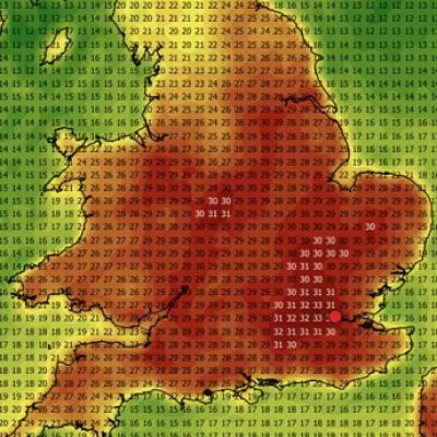
The United Kingdom is set to experience a brief spell of warm weather with temperatures reaching up to 24 degrees Celsius in parts of the country this week, before heavy rain and cooler conditions arrive over the weekend. The Met Office has forecast dry and sunny spells for southern England and Wales on Monday, while Scotland and northern England are expected to see heavy showers and possible thunderstorms.
Monday's Weather
London could see a high of 22°C later on Monday, with temperatures in the high teens and low twenties across Wales and southern England during the afternoon. Rain in the north of the UK will push southwards on Monday evening, bringing showers to southern parts overnight.
Midweek Outlook
On Tuesday, conditions will be cloudy with possible outbreaks of rain moving south and westwards. Sunnier spells are expected to develop in southeast England later in the day. Wintry conditions will ease by Tuesday in most areas, with sunny spells forecast for much of the country from Wednesday through to Friday.

Warmest Days: Thursday and Friday
The warmest weather will be felt on Thursday and Friday, with Wales and southern and central England seeing highs of 22°C. Northern England and Scotland will experience temperatures in the high teens. The Met Office expects possible highs of 24°C in the south of England on Friday.
Weekend Rain
Patches of rain will arrive on Saturday, bringing cooler weather for most of the country. In its long-term forecast from Friday to 10 May, the Met Office stated: "Conditions will probably be more changeable than they have been recently, with low-pressure systems becoming more likely. This means an increasing chance of showers or longer spells of rain, with a risk of strong winds at times. Some dry spells with some warm sunshine are still likely at times too, with a risk of a few short-lived early morning fog patches. Temperatures are likely to be close to or slightly above normal."
Detailed Forecast
Today (Monday)
A largely dry start for many, but cloudy with rain in northern Scotland. Warm and bright in the south at first, but clouding over in the afternoon as heavy showers move into the east, with a risk of thunder.
Tonight
Showers are gradually clearing this evening, leaving cloudy skies for many. Cloud will be low and thick in the east, bringing drizzle, mist and fog in places.
Tuesday
A grey start for many with drizzly outbreaks at first. Cloud will slowly lift and break through the day to bring some brighter spells. Cooler than of late and breezy.
Outlook for Wednesday to Friday
Largely dry on Wednesday and Thursday with warm sunny spells, but breezy in the south. An increasing chance of showers moving in from the west on Friday.