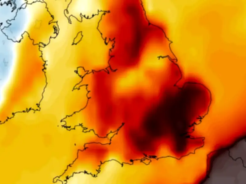
Weather forecasting models suggest temperatures in England could soon rise above 30C once more, despite the Met Office issuing several thunderstorm warnings this week.
Thunderstorms have brought heavy rain across parts of the UK, prompting the Met Office to issue several yellow thunderstorm warnings in England and Wales, the last of which expires at 9pm tonight. While temperatures are expected to drop this weekend, with the mercury possibly only reaching 23C across Saturday and Sunday, some warm conditions look to be right around the corner.
GFS model shows 31C peak in east of England
The GFS weather model shows temperatures in the east of England may rise as high as 31C on September 9, with Essex, Suffolk and Hertfordshire set to be the warmest regions. Temperature anomaly maps for September 9 also show England shaded in areas of orange and red, indicating that temperatures are likely to rise above the seasonal average.

The data suggests as many as 15 counties could see temperatures reach 29C or more on September 9. They are all in England.
UK counties facing 29C or more
- Cambridgeshire
- Norfolk
- Suffolk
- Essex
- Hertfordshire
- Northamptonshire
- Bedfordshire
- Buckinghamshire
- Surrey
- Kent
- Hampshire
- Berkshire
- Oxfordshire
- Middlesex
Is the UK facing another heatwave?
For the Met Office to declare an official heatwave, temperatures must hit the 'heatwave threshold' three days in a row. The threshold stands at 28C in the south-east, where conditions tend to be warmer, and drops to 25C the further away from the south-east you go. As this data only shows temperatures rising above the threshold for one day, it currently does not suggest another heatwave is coming.
Met Office weather forecast
The Met Office says "short-lived warm spells" are on the cards at the start of next month. Southern regions are expected to see the hottest conditions.
The Met Office forecast for September 2 to September 11 states: "Likely remaining unsettled with most areas seeing some showers or longer spells of rain at times, with the main focus for these across northern and western areas. Potential for some strong and gusty winds at times. Some drier and more settled interludes could develop, perhaps becoming longer in duration across southern areas later in this period. Temperatures are likely to be near average, although some short-lived warm or very warm spells are possible, especially in the south."